(Click to see in google maps.)
This is what happens when one goes looking around in Google Earth satellite imagery.
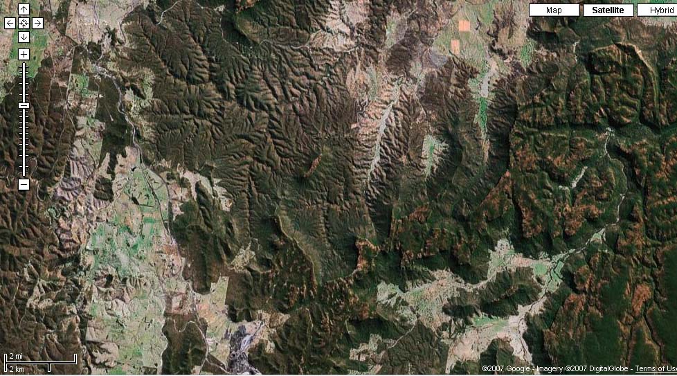
Late in 2006 I'd rediscovered maps.google.com and its satellite imagery of Earth, after having forgotten about it for a year since they brought out the Google Earth utility - which wouldn't work on my PC. This time I got into a habit of looking over Australian East Coast bush areas where I'd walked. Most fascinating to see how different it looks from above, and to see all the bits that were out of sight, behind hills, etc, while walking.
North-west of Sydney there is an area of sandstone plateaus and mesas, gorges and dry country. Much of it is in national parks - Wollemi NP, and Gardens of Stone NP. I've never previously walked in either, but from car-camping trips to places like Newnes, Glen Davis, and the Glow Worm tunnel, know how spectacular this 'stone pagodas' country can be.
So one evening, idly browsing google maps over dinner, this turns up:
(Click to see in google maps.)
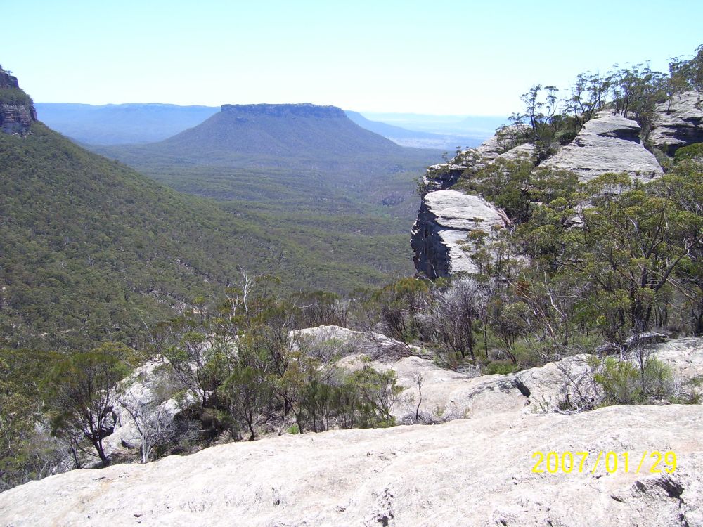
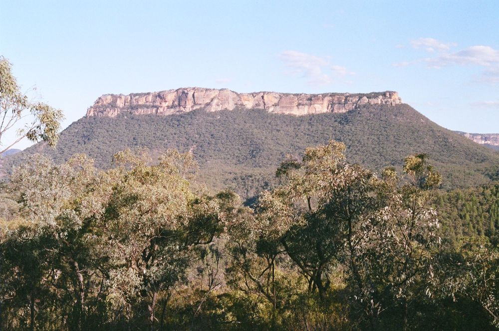
See that mountain all by itself, near the middle? This one:
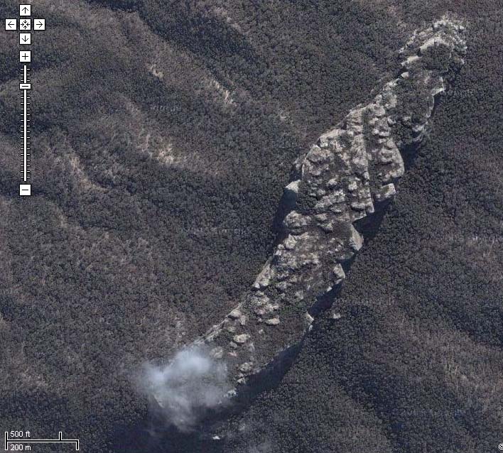
(Click to see in google maps.)
Smitten! This I've got to see in person. What is that mountain? Google has no name for it, and I don't have a topographical map of that area - how frustrating! Such a narrow, knifelike plateau, such mighty cliffs! There's also the chance occurence of that single small cloud obscuring the southern point of the 'knife' - which brings to mind an old fantasy of mine, of finding a 'portal' to another world. Of course it would be somewhere like this mountain - little known, difficult to reach, and obscured by the elements from even the all-seeing satellite eyes.
After some asking around, it turns out to be called Pantoneys Crown. Cool - it even has an odd name. It's also said to be climbable; see: www.unswphotoclub.org and www.utsoac.org.au.ns90.alentus.com
But I can't find a description of the way to it, or the ascent route(s). Looking at the aerial photos, it looks like somewhere near the Nth end would be most likely. There's a road running by it to the SE a few kilometers away, and some human-altered land a bit further to the NE.
There was never any choice really. I had to go and see this mountain. The only question was how soon it could be arranged. These days with so many uncertainties both in my own life and the world, I don't like to put things off for long, for fear that time will run out. My wife was going overseas for a few weeks on the 17th Jan, thus removing her from consideration. I wanted to at least make it possible for some adventure group friends to come if they wanted, so it had to not clash with existing group events. That set the date- the 29th Jan. I allowed three days - enough for some exploration of ways to reach the mountain, then a two day walk to it and back, staying overnight on the summit. If the attempt to reach Pantoneys Crown failed, the time could be spent instead on some car camping in the Newnes area. My son Myles was keen to come, so I thought I could perhaps offer one more seat in the car, allowing for gear.
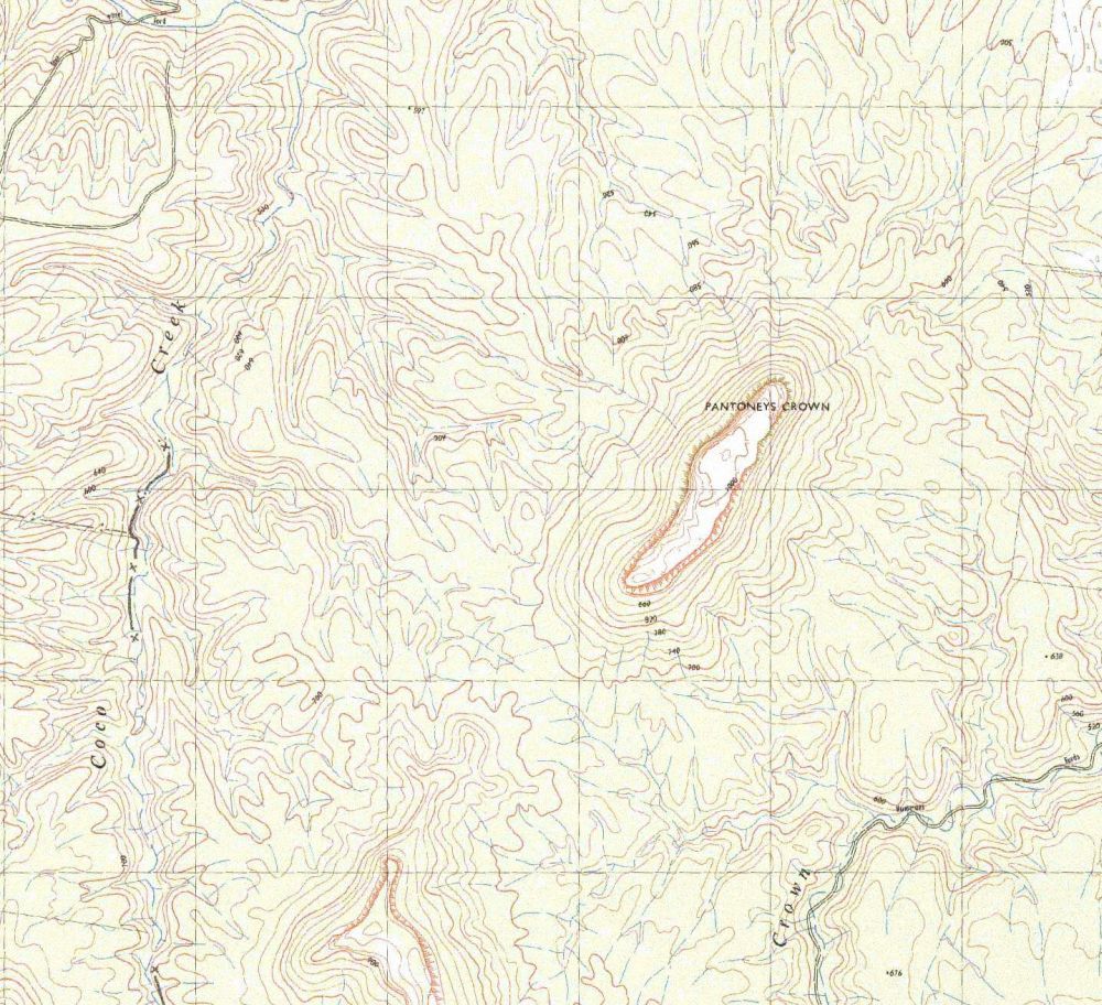
A trip into town to the Dept of Lands map sales office (1 Prince Albert Road, Queen Square, Sydney. Entry is behind the old Hyde Park Barracks building) obtained the maps. I bought five 1:25000 topo maps - a group in an arc covering the Gardens of Stone national park, and some more to the East. The one for Pantoneys Crown is 'Ben Bullen' 8931-4S. To my pleasant surprise these maps all have orthophoto maps on the other side of the sheet - images that are even more impressive than the google imagery. Much more convenient too - no computer required!
From the little information I had on the route up the mountain, it appeared that there was no serious rock climbing involved, however one photo I saw of someone climbing a maybe 5 or 6 meter vertical section, with rucksack and no rope, seemed like a bad idea to me, in a spot so far from any road. Though I have some rock climbing experience, I don't have a rack, only harnesses and rope. Also, Myles has no outdoor climbing experience. This means serious climbing is out of the question. I decided to take the harnesses and a 30m rope anyway, so that any 'awkward' spots could be done in complete safety.
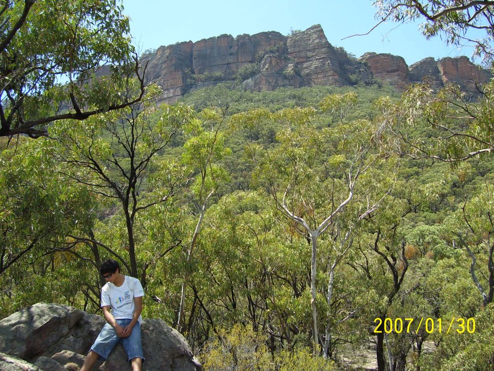
By the 28th there'd been a small amount of interest from the group but nothing concrete, so it appeared my son & I were going alone. Which was fine by us. Myles would be using Mike's old pack (friend of mine who died of cancer in 2004), which would be good. Myles also said he'd prefer to take his own small tent, which was slightly a pain, since it meant I'd have to carry all of my larger tent, instead of sharing the weight between us.
I'd got all the gear, food, etc piled up ready in the house that evening, with just a few items already in the car. One being a plastic jerry can full of water. The plan was to get up around 6am, throw everything in the car and leave by 7am.
Of course, as usual that didn't work. This time we did get up at 6am, but then discovered that the old plastic jerry can had a small crack, and so had leaked about half its contents into the rear matting and underfelt of the car, soaking it. There was no possible way to dry it quickly, so I simply unscrewed the clips holding the matting in place, and dumped it on a pile of bricks in the back yard to dry over the next few days. Threw a sheet of plastic bubble mat into the back of the car for padding and to try to keep noise down, found and filled my other plastic jerry can, substituted its broken cap, then loaded up the rest of the gear. It also turned out that Myles couldn't find his tent (despite having told me last night he had it ready), and may have lost it somewhere - he has no idea where. This was rather annoying - I'd bought it as a present, not to mention how could he be so slack? For a little while I was seriously pissed; enough to wonder if maybe I should cancel the whole thing. How the heck do you 'lose a tent'? But, decided to put that aside. Problem for another day. (Grrr!)
We got away around 8am - not too bad.
With the camping gear in the rear, and cardboard fruit boxes full of food and cooking gear on the back seat, there wasn't any spare room for anyone else after all. So it was good no one had taken up the offer of a seat.
The drive out west, up into the mountains via Katoomba and down Victoria Pass was uneventful. A bright, cloudless midsummer day, working up to probably being very hot in the afternoon. A petrol stop, and a couple of cans of V bought. One for me now - I can feel a touch of the sleepies coming on - and one for the return trip. I know I'm going to be utterly exhausted after a hot day's walking, and then driving late, if all goes to plan. The worst thing about getting old (51 now) is the creeping sleepies. Used to be I could drive all day and never even feel tired. Now I have to be very careful - 'nodded off at the wheel' seems to be an ever more likely epitaph.
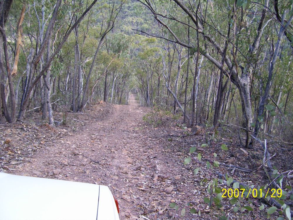
Our provisional plan is to try out the road labelled 'Bicentenial National Trail' on the map, which passes nearest to Pantoneys Crown to the Sth. For that we pass through Lithgow, on up the Castlereagh Highway, then take the Wolgan Road turnoff. Past Angus Place mine, the Bicentenial Trail is shown as a four wheel drive track turning off to the left, and following up the spur of a long plateau ridge.
We find the turnoff, and after a very short easy section it suddenly goes genuine '4WD' with a very steep rise up the end of the ridge. Right away it's clear that if anyone else from the group had come along in 2WD cars, they'd have wasted their time. But no matter to us, the Subaru is fine with it.
Some ways along the ridgeline we come to a roadworks camp, and have a chat. The fellow mentions the road gets a 'bit rougher' further on towards Baal Bone Gap, and then 'very rough' going down into the Crown Creek valley. And he's not sure, but it might be gated at the park boundary. Also the other way to get to Baal Bone Gap, via Baal Bone Creek trail, is much easier than this road. I'd thought it might be, but this way looked more interesting and more direct. We drive on. Stops for photos at a spectacular view, where the road passes very close to the cliffline top.
The exposure on this is wrong, because... I'd brought two cameras - my small digital, as well as my old Pentax 35mm (which I grabbed for this shot.) I'd made sure to have two sets of spare batteries for the digital, but of course now it turns out that the Pentax's batteries are dead, and I had to guess the aperture for a 100th sec exposure. Guessed wrong! Since a major objective of this trip is to try and take a hi-res film panorama shot from on top of Pantoneys, this is rather annoying. With myself, for not checking the batteries.
Soon enough, we come to one of the more 'interesting' features of the road. It very suddenly and steeply dives down into a narrow gulley. Looks doable, but a good idea to walk the descent first, just to be sure I'm not going to end up with the car stuck nose-down into some inextricable pit. Leaving the car at the top, Myles and I go for a scramble down the road. After a few bends it levels out in a quite nice ferny gully, and there's room to turn around if necessary. So we puff back up the slope to the car. Getting a bit warm. Sitting in the car, I ask "Ready?" Myles is, despite that with the car nosed up to the descent, you can't actually see the road forward beyond the bonnet. Leap of faith, and all that. Then we are going down. I know I can get the car back up this too, which is useful to be sure of.
A few moments of excitement, and it's over. Well, that was fun. Continuing on, we soon come to the junction with Baal Bone Creek trail, and I pull over there to check the map. While stopped, three heavily leathered trailbike riders come up from behind, slowing carefully as they pass us, waving. They look as thrilled by the recent 'descent' as we were. We catch up with them a few minutes later at the Gap, and chat some. By now it's very hot, and these full-leather guys are even more glad than we to find that the thing marked 'Pressure Reducing Station' on the map should be better labelled 'big pool of cool water in shade.' It's a large, low concrete and corrugated iron structure, that has an open hatch and a pipe inside pouring water into a wide shallow reservoir. Wonderfull! Drinking water for the farms in the valley below no doubt, but a face dipped in the water shouldn't hurt.
What does throw a spanner in the plans is the discovery that the road on down the pass is indeed gated and locked. It's a very steep and rather rough looking road too - another case of 'walking it' first, and this one would mean a looong walk since it's at least 300 meters down to the point where the road would start to level out. Still, gated. We have lunch while thinking about what to do next, then go for a quick climb up some nearby stone slopes to see the view from above the treeline.
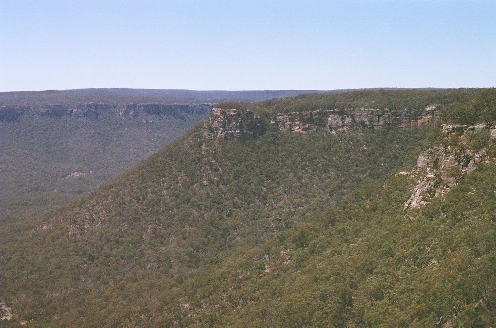
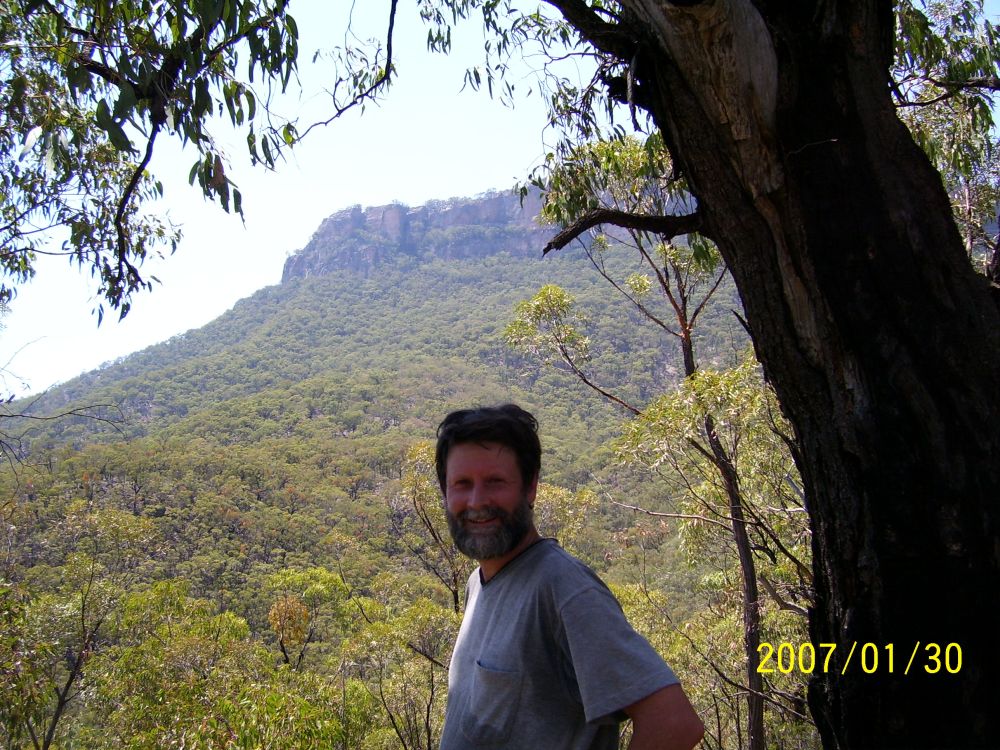
Now, for the first time, we see our objective. Pantoneys Crown is dead center in our view here. For the first time I see its clifflines from a viewpoint other than directly above. Yep, those are big cliffs. They look completely impassable, except perhaps at the northern tip, where there's a degree of brokeness about them.
 Pantoneys Crown from Baal Bone Gap
Still hoping to be able to approach closest to Pantoneys Crown via the Bicentenial Trail, I decide to drive around to the north via the Glen Davis road, and try the other end, via the farming area. This time we return to the Castlereagh Highway via Moffits Trail then White Gate Trail, which are pretty much 2WD rated the whole way back.
At the moment it's a priority to try and get new batteries for the Pentax, so the first person I see to ask about nearby shops, I stop. He's a local selling home grown peaches and nectarines by the highway, and they look delicious, especially given the midday heat. He says there might be a shop in Capertee, which is before the turnoff to Glen Davis. I buy a bag of peaches, and go back to the car to look at maps. Myles and I dig into the peaches - yum! They are SOOO nice. I go back and buy another bag of them, plus a bag of nectarines. I don't know how grateful we are going to be for these, later!
In Capertee, there is one service station/shop. They have a very small range of camera batteries, but no equivalents chart or prices for them. None are the same number as my camera's batteries, though there are some that look the same physical size. I buy two - she makes up a price, which surprisingly is less than I'd expect to pay. They work! Plus some icecreams from the freezer, and everything is going great again. We set off once more.
Coming over a rise on the Glen Davis road gives a view of Pantoneys from the opposite side. Baal Bone Gap where we were before is in the far distant cliffline.
Pantoneys Crown from Glen Davis road
However 'going great' doesn't last. Along the Glen Davis road, there are a succession of 'private property, keep out, no tresspassing', etc signs. At the turnoff that is most definitely the one shown as 'The Bicentenial National Trail' on the map, there is even a very adamant "NO ACCESS TO GARDENS OF STONE NATIONAL PARK' official NP sign. As well as the usual 'private property' etc warnings. I take that road, since at least the gate is open. The others we'd seen were all closed and locked. There is very definitely NO water in any of the creeks - everything is dry as a bone.
The next few hours of mid-afternoon hot frustration are too tedious to relate in detail. The area is a maze of small hobby farm holdings and minor roads. There are roads not on the map, and roads on the map that are just ruts across fields (and gated.) Following the general rule of 'if its not locked, just try it, ignore the 'keep out' signs, and be friendly and ask anyone you see', we literally tried every possible combination and path. Nope.. fail.. fail... nope... That sign wasn't kidding - there really is no access to the park through here. At one point we stopped and asked a couple working on a vehicle beside the road, and they helpfully suggested we try another route further up the road, through a property they suggested was only recently bought, and unoccupied. That didn't work - locked. From careful map reading, we determined that in fact the actual 'Bicentenial Trail' was the front driveway of the property who's owners we'd chatted to before by their vehicle. We drove back there - now no one around. I walked up to the house on the hill, map in hand. Fellow was quite friendly, but said that yes, that trail was his front drive, and I would be welcome to use it, but... further on, at the park boundary, there was a solid fence and NPWS-locked gate. No, he didn't recall anyone coming through on horses. He volunteered that sometimes Oz Army groups would walk through, via the other neighbour's road, having done Pantoney's Crown. They'd have a water cache laid in for them at the road, and he thought they reached the mountain from somewhere on the other side, to the West. He'd heard there was a visitor's book at the top. He had never seen these orthophoto maps before, and thought them rather cool.
Back to the car, and getting a bit frustrated. Its getting late in the day, around 4pm now. There's only one possibility left for approaching the mountain, and that's via the Airly Creek Trail, from Glen Davis Road. And time will be tight. We head off immediately. Back to Glen Davis road via Crown Station Rd. Going back up the ridgeline on Glen Davis Rd, I make sure Myles is closely matching the road features to the map, so we can exactly identify the turnoff. No time for uncertainty now.
We come to where the turnoff is supposed to be, and find a large open graveled area beside the road. No turnoff visible. But it has to be here. We get out and walk around ... ah! There it is! Very well concealed - the dirt road just dips down from the lip of the gravel dump, and you can't see it unless you are standing right next to it.
It's another 'over the edge' driving experience, then after a short steep descent the road becomes a quite pleasant smooth bush drive. For a while, till it reaches Airly Creek. Then another 'straight down this steep ridge, by gum!' thrilling drive. The shame is that when you take a picture from the car, looking down what is a maybe 40 degree slope, in the photo it just doesn't look steep. No one ever feels like getting out of the car and taking a level shot as it goes by, then running after it.
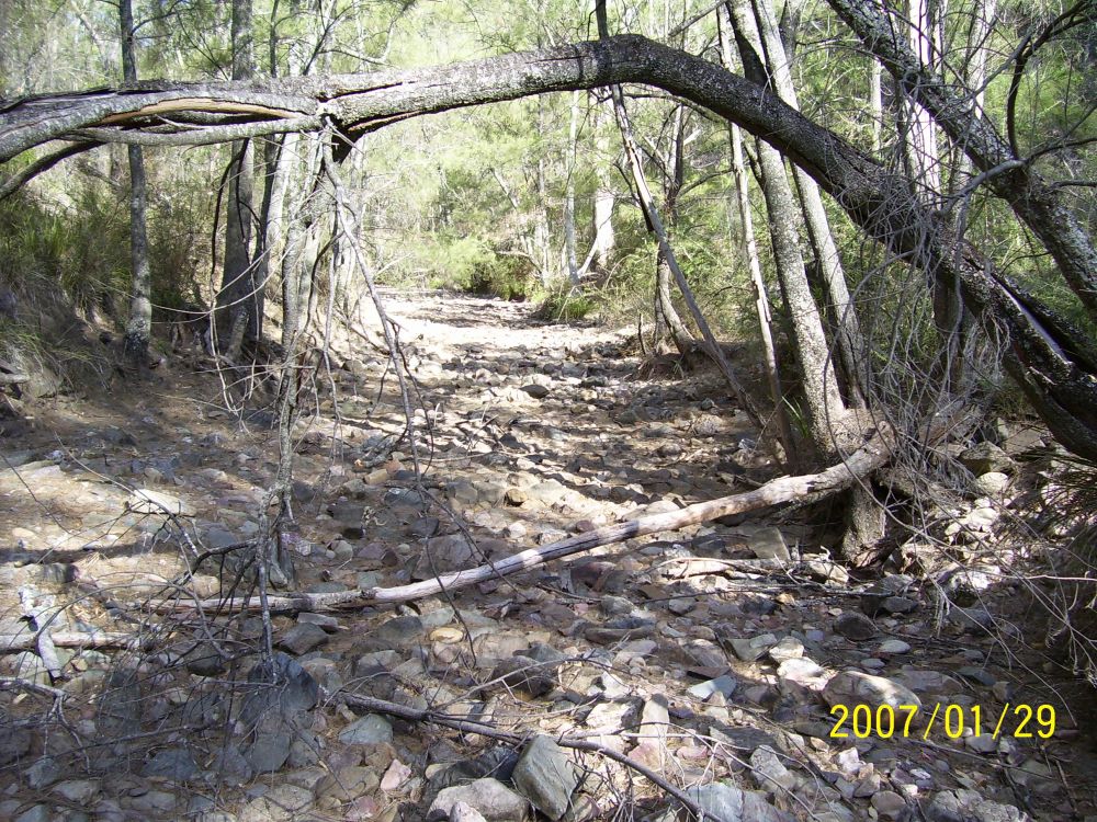
At the bottom, we took a rest and snack in the absolutely dry pebble creek bed. It's covered with acacia needles - been a while since any water flowed here, and this is a major creek. Obviously the recent rain we had in Sydney didn't happen around here. There isn't going to be ANY water where we are going.
Airly so called 'Creek'
I'm considering how hot and dry it is, and what it will be like walking for two days in rough country in this heat, with no water but what we can carry. Back in Sydney I'd casually thrown quite a few empty one and two litre PET soft drink bottles into the gear boxes, thinking we might need a few for the walk. Now I'm thinking 'a few' might not be enough, and exactly how many did I bring? How many can we carry, full? We'll see.
It's now about 6.30pm, and we don't hang around too long. A much appreciated orange each, some more of those wonderful peaches, and we are off.
Turns out the road going up the other side of this gully is the most extreme we've yet encountered. Very steep, moderate erosion trenches, narrow, sharp drop-offs to one side. Suddenly it's a do-or-die proposition, with no way back out of it. Even in 4WD-low-1st gear the engine is struggling, and I have to keep the car going faster than I'd like, or risk stalling. NOT wanting to stall, since a 'hillstart' here is out of the question and so is backing back down this road. Visibility ahead not good due to steepness and 'bonnet in way' effect. Bit of screaming 'come on! come on!' and then its over. The top, we made it, and calm again. I do NOT want to have to go back down that. Did I mention that the rocks in these parts form jagged triangular shards, that tend to stick straight up from the road surface in tyre-slashing form, and which must be avoided while still keeping the speed up, not dropping wheels in deep ruts, etc? Only have one spare tyre, and it's a long hot walk back to the main road.
After that excitement, the rest of the road along the ridgetop is positively flatness heaven. The turnoff towards Pantoneys turns up as expected, and we head down that. This one is 'two wheel ruts' grade, and I'm a little worried about grassfire from the hot exhaust pipe. But no smoke. There's no sign of any other vehicle having been here (or anywhere along since the main road) for a long while. Towards where the road should end, there's a small fallen tree across it. Doesn't seem worth moving, unless there is a great campsite further on, so we walk down it the rest of the way to the end. There, there is a rather great panoramic view from a promontory with cliffs below to three sides, and a few trees on top. To one side, an excellent view of Pantoneys; the closest yet. It would be a nice campspot, if the entire area wasn't a mass of large ants nests. How do ants survive without water, anyway? As we walk back up the hill to the car, I'm thinking about how we'll start off tomorrow. There are cliffs below here, but back where the car is parked it looked like the country dropped off more gently into the valley we need to cross first. So it's better to start from there anyway.
In the end I drive back a bit up the road, to a spot with flat ground and a decent view of Pantoneys to the East.
From the car camp spot. Looks close, huh? It's not.
It's hot, there isn't much daylight left, so we have dinner straight away. Propane stove in middle of dirt road, heat large can of thick stew. Plus fresh peaches, and assorted snacks, and lots and lots of water. I put the tent up, outer cover folded back for best breeze through the inner fly mesh. The folding camp stools feel great, and we both read books in the last daylight.
Also discover that just by lucky guesswork we have camped right above the very end of the cliffline, where it peters out into plain old slope. Perfect! Comparing the orthophoto and topo maps to what I can see from here, I realise that the optimal route from here to there is amazingly an almost perfectly straight line, following one ridge side down from our campsite to the first creek, up and over the end of another ridge, then up along a long more or less straight ridge to the final rise to the base of the cliffline of Pantoneys. Then a skirt around the base of the cliffs, looking for a way up. If necessary, going right around it. Returning the same way - although I can see one potential problem with that - getting started on the correct ridge coming down off the flank of Pantoneys. Hard to do when you can't see much but the trees around you. At dark we retire for the night. Tomorrow, the mountain.
First was the water. It turned out I'd brought enough bottles for us each to have two 2 litre bottles, and two 1.25 litre bottles. 6.5 litres each, for two strenuous hot days. I knew it wasn't enough, but it would have to do. Half the tent bits each, plus sleeping bag and mat each. Light rainjacket (Ha! As if! But just in case the weather does change, its essential to take.) One pair warm shirt, light jumper, long pants each. Wear shorts, t-shirt, walking shoes. No change clothes- it's only two days, and we won't be able to wash anyway. A hat each, and roll-on insect repellent.
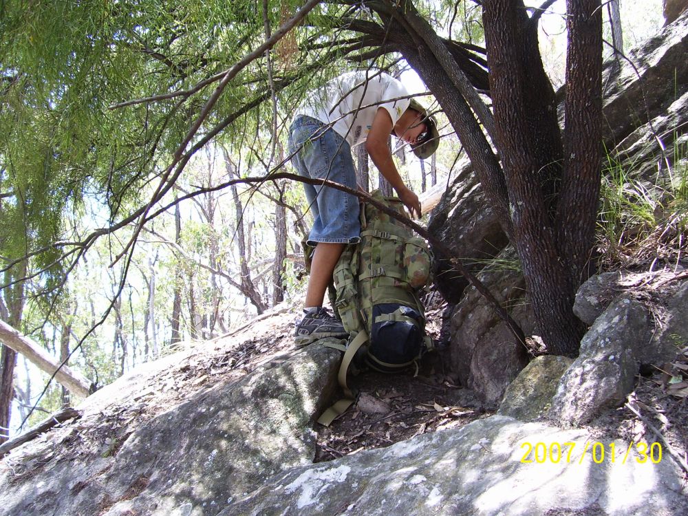
One climbing harness, figure-8 descender and screwgate D ring each. One 30m rope. I added a single medium cam and plain carabiner to my kit.
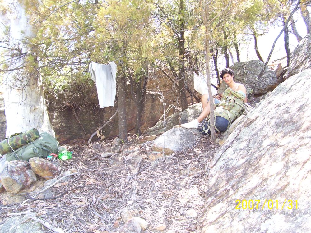
Food: There would be no cooking on this walk. Fires absolutely out of the question, and no fuel stoves either. Rather than rely on dried food, I took one large can of stew for a main meal (its wet, and I'd tasted the other one last night before heating it - it was fine cold.) Also took enough meusli for one breakfast each, premixed with powdered milk. Bread, cheese, butter in a plastic screw-top container, can sardines, salami, nuts, figs, two mars bars, and four oranges. Didn't take any cooking gear, just two small plastic bowls. Almost all of this fitted in one of my drawstring cloth bags. I carried most of the food, Myles got the rope.
There's also my standard kit in small cloth bags: toothbrush etc kit, first aid kit, toilet paper bag, bag of cords, and eating kit (also has stuff like compass, matches, salt, etc, so it's really a 'top of pack' kit.)
Lastly the two cameras. Sigh. Heavy.
It all fit quite well in the packs. As usual I had to tie my foam sleeping mat on the outside, wrapped in a light groundsheet to stop it getting ripped to pieces by bushes. Myles' pack, being bigger, fits everything inside. Overall, my pack is somewhat heavier.
All the perishables that are staying go in the esky, and that gets covered with all the blankets and towels I have. It's going to get hot in the car.
Last thing I do, is write a note and leave it on the dash of my car, readable from outside. Who we are, where we are going, when expect to get back, home contact numbers. You never know.
We head off about 8.30 am. All easy downhill walking to Coco Creek, and that doesn't take long, though it's heating up fast. Bone dry creekbed, as expected. Same story - a thick layer of acacia needles indicating that water rarely flows here. I'm beginning to see why this 'national park' is made so difficult to reach. It could not take much human access. We have a rest here, next to a small cliff.
Myles, at Coco (not)Creek
Then it's up over the end of the ridge that is crossing our path. Steep, hot work. Rather than go straight up, I cut around to the left, so we don't have to climb so high. At the apex, looking back, it's nice to see that the line of cliffs near our car is very unique. It makes a good marker for the return trip. Then it's a matter of working around the side and down again to the next creek at the point where our target ridge meets it. We have another rest there, and I make a small stone pile cairn in the creekbed. Thinking of the return - it's always nice to be sure you are in the right place.
By now we are only one third of the way to the even the base of Pantoneys, and most of the hard work remains to be done. Setting off up this ridge is already feeling hard. It's steep, and hot. We are both well into out first 1.25 litre bottle of water by now. After what seems like a long struggle, we come up over the knee onto flatter ground among some large white-trunked gum trees. They offer some shade at least - most trees around here seem to be fairly sparse, and good shade is rare. I think this was the point we started taking our sweat-soaked t-shirts off while resting, and discovered that this way they feel nice and cool when put back on. Briefly.
Then the long, scratchy ridge slog. This ridge top is only slightly uphill, but disappointingly it wasn't the kind of easy walking open bush I'd expected. Some parts are quite dense, with intertwined spikey and scratchy small shrubs. Since it was totally too hot to wear long pants, our legs got fairly scratched up. But it was more of an annoyance than a real speed loss. Now and then I leave a marker - a few stones in a row, or on top of each other.
It was past midday before we even got to the upturn of the steep slope skirt around the base of the mountain.
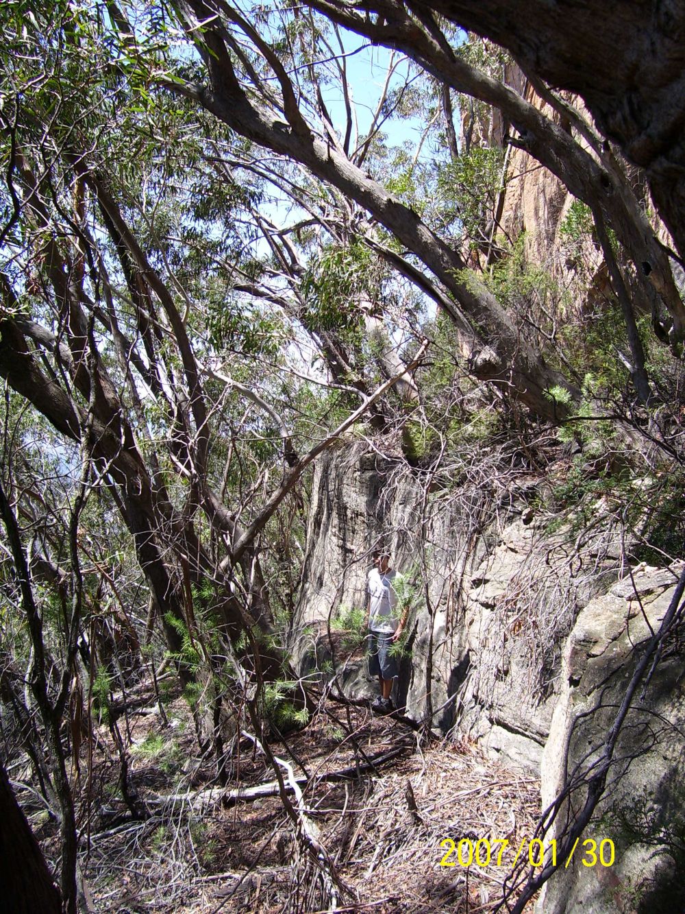
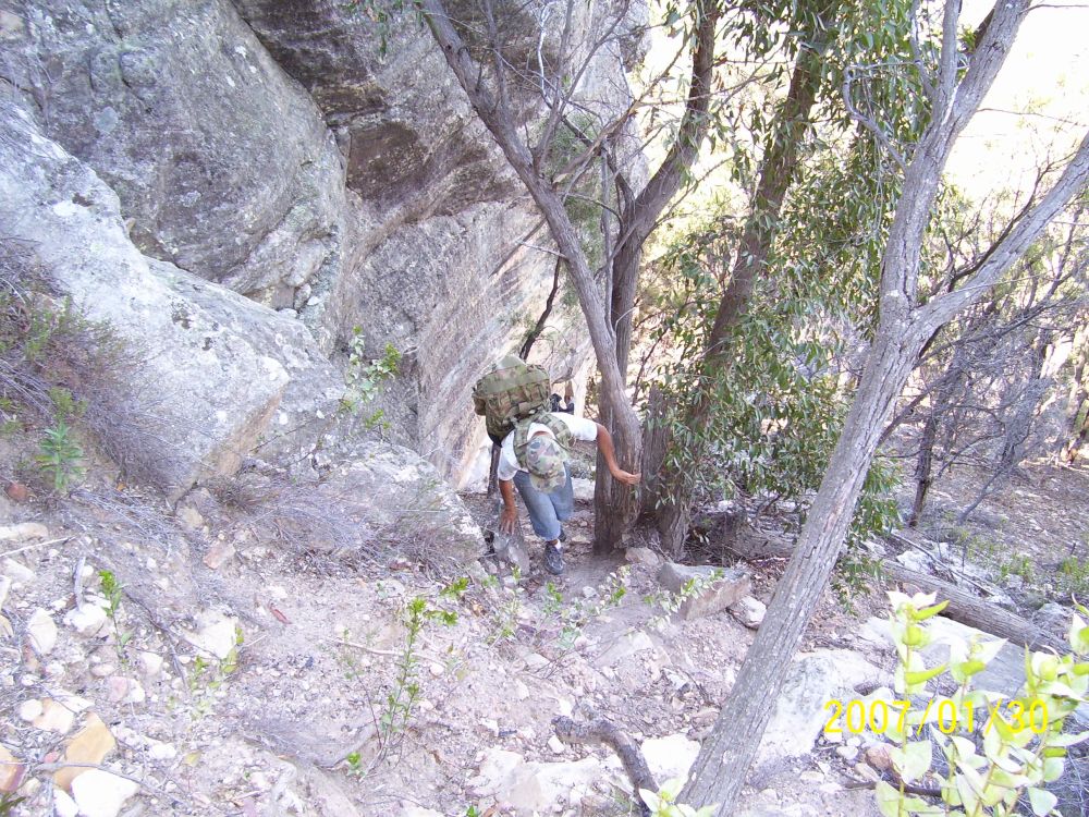
From then on, it was Climbing. Climbing... through alternating varieties of vegetation. Sometimes the dense wiry shrubs that sort of interlink. Sometimes the stands of small trees that died of drought years ago, and are now a mess of dead, partly fallen crumbly limbs. Sometimes the fairly open, semi-scree slopes, where every rock is loose, and tends to roll into the shin of your other leg (ouch!) Sometimes the piled tangles of bark, branches, leaves, and so on, that completely hide whatever (unstable) surface is underneath. But almost never enough tree cover to provide useful shade. Now and then we'd come across a boulder or outcrop with a small cave or shady side, and take a rest.
At one point, perhaps half way up the skirt, there is a rocky outcrop where the ridgeline narrows. On the outcrop there are two large boulders close together, with a space between them. Some form of small tree with a foliage more kharki than green, but who's leaves form an almost complete sunscreen, has grown here between the two rocks. The result is a small, cool oasis of extremely welcome shade. By now, we were also both into the second of the two 1.25 litre water bottles. Fortunately my gear included some salt tablets, and we'd both felt the need to take one already. It was already well past 1pm. We decided to delay lunch till we reached the base of the cliffline.
The knoll just above the 'two stones oasis' is already high enough above the surrounding country to give a view back to where we'd come from.
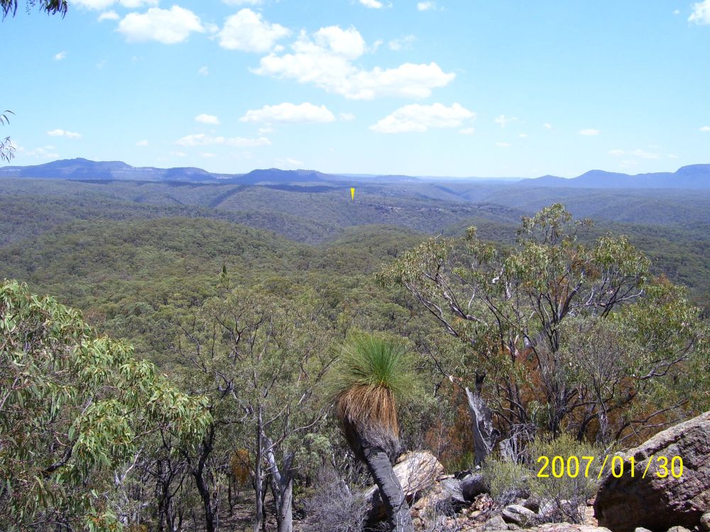
Yellow arrow is where our car is parked
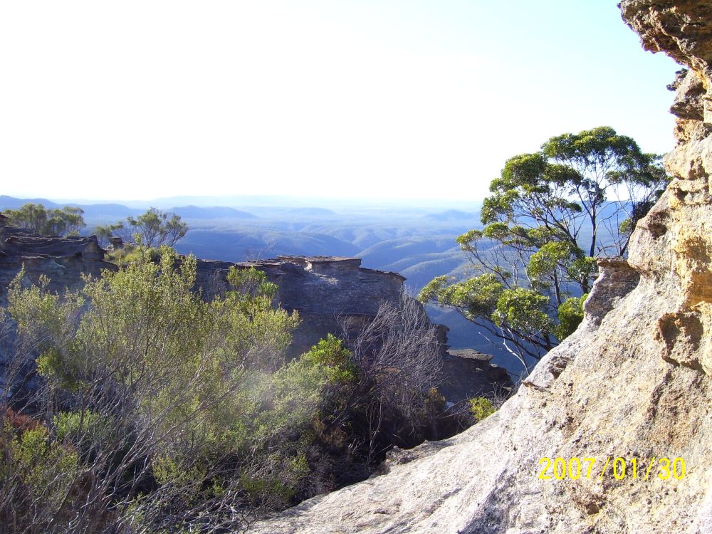
From here we also had a good closeup view of the cliffline above us.
It was pretty obvious that there was no way up anywhere on this side of the mountain. We could also see that at this altitude there were still distinct ridges to either side of ours, but they merged into the general sloping skirt of Pantoneys some way above us. The one to the Sth of us had a markedly reddish patch on its flank, bare of vegetation, at some height above us. Remember that!
From here on we ascended the slope in a diagonal direction, trying to take off some of the distance we'd have to cover along the cliff base later, in working around to the Nth end. In the heat this steep slope is slow going, many rests.
Typical 'rest spot' on the slope
We get to the cliff base around 3pm, utterly exhausted. Lunch time!
The non-magnificent lunch spot.
Sitting eating, and contemplating the situation, it's obvious we don't have enough time to work right around the base today, if we can't find an obvious way up. And in any case, it's also clear that there is no way up anywhere along this side. If we can't find a way up today, we have a problem - where to spend the night? There is nowhere flat enough anywhere near, and we already don't have time left to even make it back to the last creek we crossed. Seems like the only thing to do it to stick to the plan, and hope the way up is at the Nth tip, or just around the corner. If not, perhaps there will be a cave or something we can stay overnight, then head back tomorrow. We are both feeling the heat pretty badly, and not feeling terribly eager to get going again.
But some food, an orange each and some more water improves the outlook, and we set off. Unfortunately, these cliffs are not the sort that have relatively level baselines, and it's still rough going in spots, with a fair amount of up and down. The sun, being in the West and us on the West side of the mountain, is beating rather directly down on us and there is little shade. We are looking forward to getting around the end of the mountain, and into its shadow. Looking up the cliffs is dizzying.
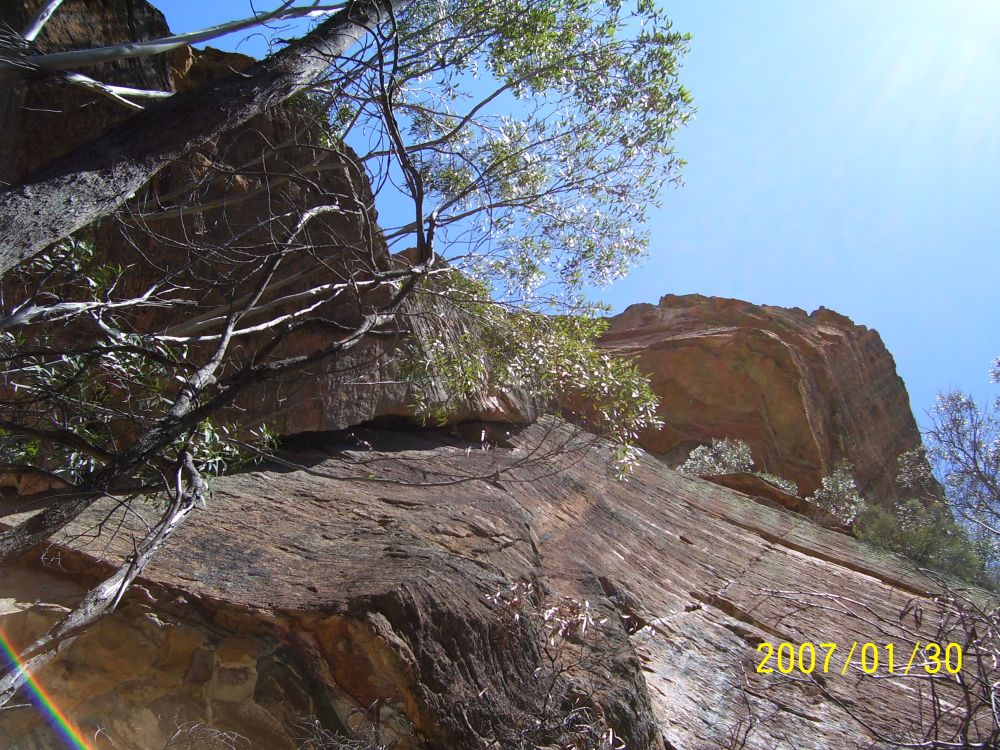
Cliffs. Up. The effect never comes across in pictures.
I'm also surprised there is still no obvious sign of human tracking. Not many people come here at all. Its also hard to tell where, exactly, the 'end' of the mountain is. Not much view out through the trees, and it's all quite rough and broken up. We find a series of crevices and 'could almost get up here' spots, one of which seems to remind me of the picture I saw on the net. But is this it or not? The climb is a bit much... We decide to down packs, and I'll explore a bit further round while Myles takes a rest. He mentions he has a headache, and I get him to drink more water, hoping it's just dehydration, not heatstroke. I'm feeling a bit heat-fuzzy myself.
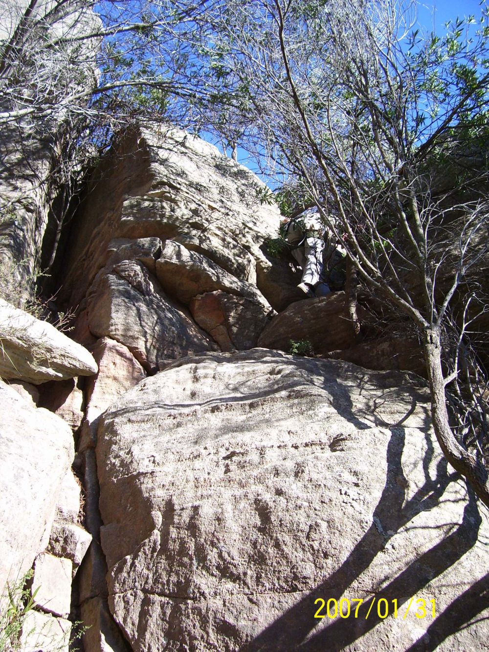
To my great relief, not much further round there is first a rather nice cave, that we could camp in, and then just past that suddenly there is an obviously much-used human track, forming up where a rubble slope goes up into a wide gap in the cliffline. No 'this is the way' sign needed - it clearly is. I go up a little way, it gets more definite. Woohoo! So we may yet be able to make it up there today. By now it's around 4pm. I head back for Myles, and we quickly begin the ascent.
Beginning the final ascent.
After the initial easy start, following the 'trail' gets a bit more difficult.
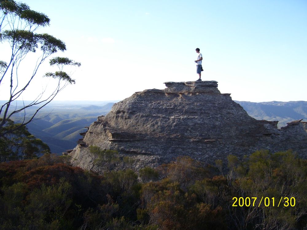
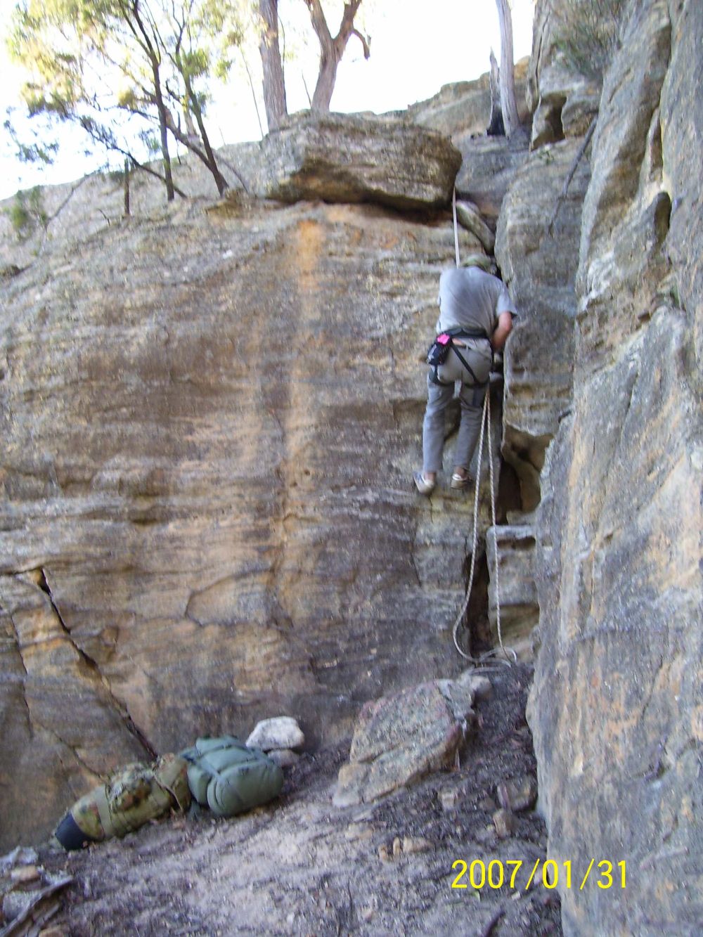
As usual when a bunch of different people who don't know the way are searching for it, every possible fork off the right path has been worn. Making it difficult to figure out which is the right way. Only method is to fully explore them all. But what is 'fully', when one is several hundred feet up the side of a semi-cliff? No... this can't be right, I'm not doing that, no way... How about this... hmm, yeah... Again, I got Myles to sit it out while I explored. And then, once I'd climbed some stuff I really didn't want to do with a pack on, and another spot that was easy really, but felt far more exposed than it was, and I'd come up over an edge and found a cairn, and a bit further on 'that climb' - most definitely the one I'd seen on the web, with the fellow freeclimbing it with pack on, and above that I could see a red marker tape on a bush, and that, up there looked like it must be THE TOP... then I knew we were going to be able to do this. If we hurried.
Back to Myles, and get us both harnessed up, and rope unpacked. Everything easy from here on, but three points where I insisted that we rope the packs up, and I belay Myles while climbing. All went without any hitches. Then that final climb, just below the marker tape. This one was a bit more than I wanted to freeclimb myself, even without the rucksack. Sure, easily doable. But one of those 'if something goes wrong, we are both really f*cked' things. So, a quick lesson for Myles in how to bottom belay, and and I start up with crossed fingers that the one cam I had would fit the crack I could see part-way up. It did. Feels so much better knowing you won't fall all the way. Rest of climb easy. Nice big solid tree for me to belay Myles from. Packs rope-hauled up, then Myles comes up. One more easy little climb, passing packs up by hand, and... we are on top!
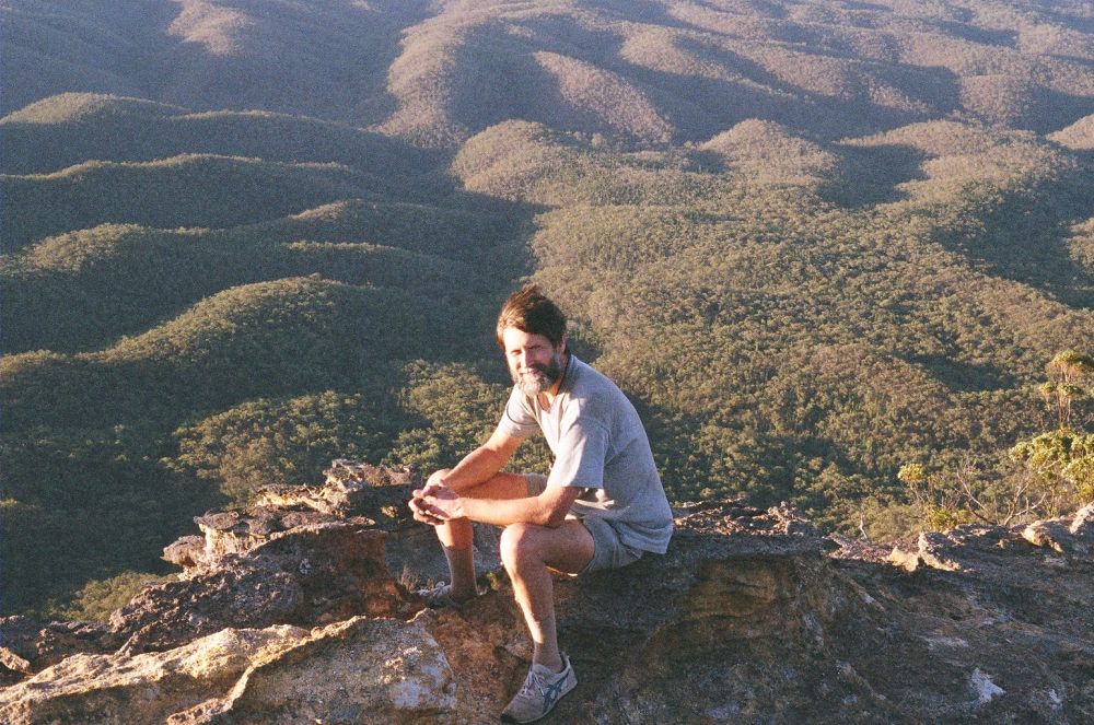
By now it was about 6.30pm or a bit later. We took a couple of quick photos
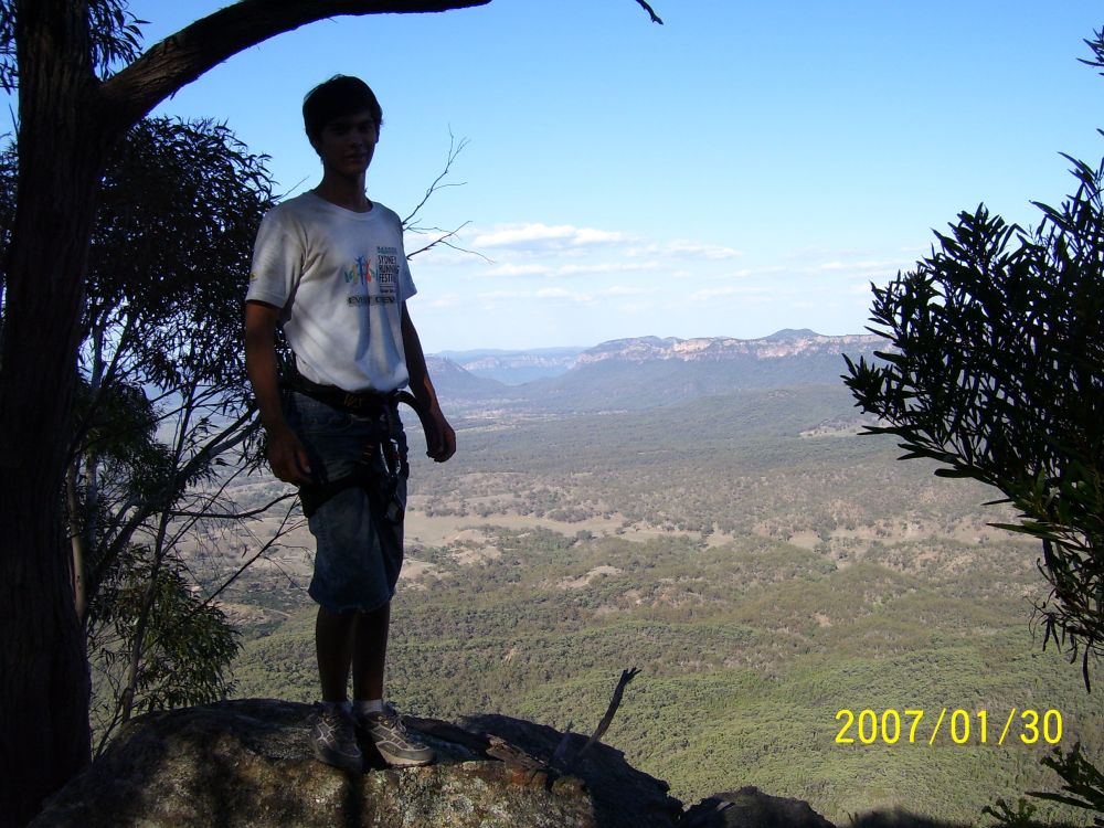
then headed off, still wearing the climbing harnesses, to find a camp spot and have a rest.
The top is more or less flat, but with lots of intricate stone pillar detail. We found a flat spot that would do for camp just a short distance away, and sat for a while, resting. But, considering that tomorrow it would be best to head down quickly before the day warmed up, we should do our exploring now. So leaving the packs and climbing gear there we set off, with just cameras.

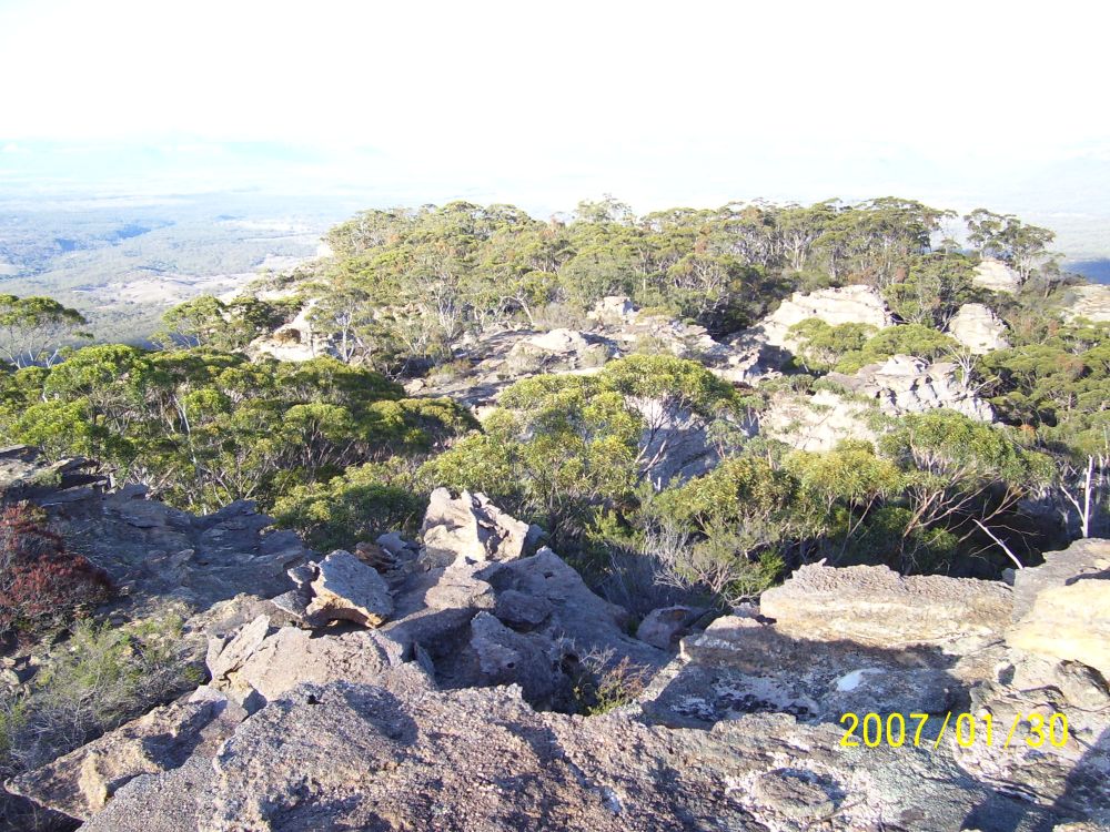
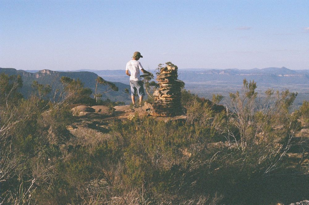
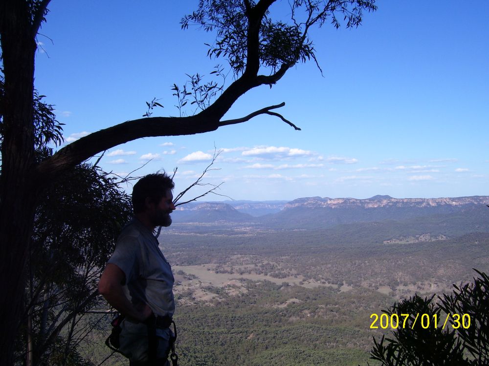
The highest spot is more or less in the middle. There is a piled stone cairn there, but no visitor's book. There is one rather bizarre object, which one can only presume was left there as a joke. The view is as fantastic as I'd thought it would be. The stone formations of Pantoneys Crown are amazing, and got even more spectacular as the lowering sun painted them in shades of orange. I took the film panorama shots I wanted to, and here is what they look like stitched together. Click on thumbnail for the full sized image, will take a while to download. Too bad I didn't have a tripod.

There wasn't time to try and get to the southern tip of the mountain, and probably little point. Though, this made me a bit sad — I didn't get to see for sure there is no portal where that cloud was hiding the very tip. At least I can still dream that perhaps it is there.
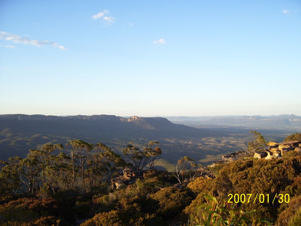
It was interesting to look back over the country we'd walked today, laid out so far below with its shape highlighed and shadowed by the low sun. Almost like looking at a satellite image - a rather amusing symmetry, since that's what brought us here. We could see the exact spot where the car was parked, although not the car itself. The distinct cliffline we'd be heading back towards tomorrow was the only one in the entire swathe of country out there — a pleasant thought to be sure, that confusion was impossible.
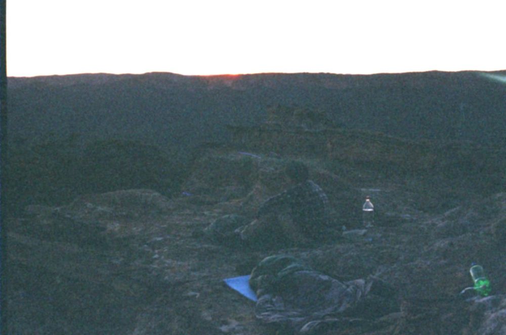
On the walk to the top we'd found two much better camp spots than where we'd dumped the packs, so we went back and got them. Myles had the idea that he'd prefer to sleep out on the stone formations next to the campsite, and I agreed. It was clear, warm, a nearly full moon, and rock isn't so bad with a sleeping mat, so long as you can find the right shaped spot for hip bone. I set the tent up among some trees anyway, just in case the weather changed overnight, then we ate our no-cook meal sitting up on the rock where we would sleep.
By now I was almost finished the first of my two larger water bottles. Leaving just one 2-litre bottle for the return trip. Myles had done better, with more water left than me. But then, it seemed like he'd come closer to significant dehydration today, what with the headache. I figured it would be OK tomorrow, didn't matter if we ran out a while before getting back to the car, since once we did there was plenty of water there.
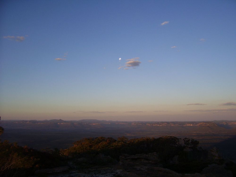
In the last couple of weeks there's been much talk on the net about Comet Mcnaught, said to be highly visible in the early evening western sky, just after sunset. Due to living in Sydney, and with no nearby unobscured view of the horizon, I'd missed seeing it myself. I knew it had passed best viewing, but had hoped that from up here it would still be visible. Sadly, as the sun set, and stars came out, it was not. Too late, oh well. However, it was a three-quarter full moon, and so the magnificent daylight view became a mysterious moonlit view, which was fine too. The weather was still perfect - a warm, gentle breeze with a few little gusts now and then, clear skies. No insects up here - I suppose they all get blown away. A few distant farm lights in the open valley to the north. We lay back in our sleeping bags, shoes and spare clothes for pillows, and admired the stars. Even with a full moon, they were so much better than in the city. A few shooting stars, and one very bright satellite traversing quickly from Sth to Nth, still illuminated by the now hidden sun.
Our beds were comfortable enough, but I have to admit that despite being tired, the combination of very bright moonlight and intermitent wind gusts was enough to keep me awake for hours. Only in the early hours of the morning, once the moon had moved low in the sky, and the air grown cool enough to allow zipping up the sleeping bag, did I finally get to sleep well.
We'd discussed the plan for the next day, and both wanted to get up and away as early as possible. For one thing, the earlier we started the more of the initial walk back around the cliff base and down the mountain's skirt would still be in shade. Today's experience had taught us great respect for shade.
I awoke with the first glow at the horizon in the East, and woke Myles up. Took a couple of photos with the sun just about to come up, but of course in my rush forgot to adjust exposure to compensate for the bright horizon. So those shots are failures. Still, just to prove to certain people that I am capable of rising before the sun (sometimes), behold:
A very quick breakfast and packing up, and we were off by 7am, heading back along the top to find the descent point. Which of course, I missed on first attempt - we went too far to the Eastern edge, and for a few confused moments couldn't figure out what went wrong. Then a reorientation, and we quickly found first the place where we'd originally left our packs yesterday, then the edge with the red marker tape on a bush. Already harnessed up, I looped the rope around the tree we'd belayed from yesterday, and Myles absailed to the bottom of that climb. Then we lowered packs, then I absailed down. A moment of delay during which the rope jammed and wouldn't pull down, then it came. From there on we repeated that routine at each tricky spot. During the ascent it had not been possible for me to take photos, since it was busy, or I was belaying, and so on. This time, with Myles at the bottom of each section as I descended, I got him to take a few pictures.
By the time we were at the bottom of the cliffline the sun was already getting deadly hot. I'd thought we might get far enough before it got warm, to make it possible to wear long pants through some of the early scratchy stuff on the downslope. But no - by the time we finished the cliff descent, we were already dripping sweat and had to change to shorts. We packed away the climbing gear, and hurried to get further around the cliffs and back into shade. A great relief when we did.
Finally, after what seemed to be lot more scrambling than yesterday, we reached where we'd had a late lunch at the point we'd first reached the cliffs. By now the sun was swinging around the end of Pantoney's, and our shade was gone. It was already obvious that today was going to be a lot hotter than yesterday. Oh good...
Next comes the difficult part. Yesterday we'd come up the very steep slope at a diagonal. In reversing that we had to get it pretty much right, in order to end up on the correct ridge line at the point where one slope formed up into several distinct but similar ridges - each one heading off in almost the right direction. Except all but one ridge led far from where we wanted to go. No mistakes allowed! I'd made some small cairns on the climb up, but I knew it was useless trying to follow those. Too few cairns on a big, very rough slope, visibility not very far due to trees and random giant boulders. The one marker I was going to be damn sure I found, was that knoll with the 'cool oasis' between two stones. Once we found that, we would be on the right ridge. Once we were at the right altitude in its general vicinity, that knoll should be fairly visible.
So down we went. Trying to keep to about the same angle to the side as we'd made coming up, but you know how it goes. Not a sign of any of my cairns, though we could have been just meters from them and not noticed. Huge boulders all look alike too, especially when seen from the opposite side from before. Descending, descending, and getting hotter all the time. Absolutely no visibility of the shape of the landscape out below us. Fingers crossed, when not clutching at branches to stop from losing footing on the very, very steep slope. Going down is just as hard as coming up.
Some while later, at what felt to be about the height that the distinct ridges should be forming, the slope began to be more detailed. But... which bump becomes the ridge? Nothing looked familiar (a feeling I'm quite used to, and expected.) My instinct was that we should be fairly close to the right line, but I wasn't sure if we were short or far of it. Perhaps a bit short. So, we tried skirting around a bit to the south on approximately the same contour, but discovered that we'd been down in a bit of a gully, and had to climb a steep, fairly bare slope of reddish gravel to get onto the line of the next ridge. This didn't feel right, but hopefully from the top of it there'd be more view. There was, but it didn't help. No sign of our distinctive little knoll, just generic ridges. Skirting further round into the next dip, it got to feeling even more wrong. So we found a spot of shade beside a large boulder, and after a rest I suggested to Myles I'd go for a scout around, leaving the packs with him. Way too hot by now to be tracing back and forth experimentally, with packs.
I headed off further around the contour, going to the Sth, and a bit more down, trying at every break in the tree cover to spot that darned knoll somewhere on the slopes below.
Soon after I'd left, it occured to me that I'd forgotten to mention to Myles that on NO ACCOUNT should he leave the packs and go exploring too. Great way to totally lose the packs and never be able to find them, that. I knew I'd have to be cooeeing him to find the same spot again myself. Hence, he needs to be there. Still, I trusted him to have the sense to realise that.
Further round the hillside, and I meet some surprisingly deep and steep gullies, almost canyons. The sort of things you can't see below treelines from a distance, so this tells me nothing about where we are. I skirt back uphill a bit, and around them. Onto the next major ridge. Go down this a way, hoping for a spot of less dense vegetation and a view. Find it, but... just more generic ridges to either side. Eh? Looking back uphill, I can see the cliffline, and realise that actually this is way too far to the south now. It looks like I'm now in the centerline of the semicircle of cliffs on the southern west half - well past where I want to be. This means we must have been just a bit past the right line where we stopped, rather than a bit short of it. Back to Myles.
Its now something like 11am, and very, very hot. I've been walking hard, and even with no pack the heat is getting to me. Naturally, by the time I'm 'in the vicinity' of where he is, I'm at the wrong level, and can't find him. Shout, and he answers. Ah, I'm too low. More climbing. When I get to him and the packs, I just want to have a drink of water. Tell him we are too short, and have to go back around a bit. He says "That bit of bare reddish ground we climbed up - that might be the spot we could see yesterday from the knoll." Ah yes, he's right, it might.
Grunting the packs back on, we walk the couple of hundred meters back to the ridgeline just where that redish earth slope meets the top. If we could see this from the knoll, we should be able to see the knoll from it... You'd think... Looking around, at first we can't. Move a bit, to get a different set of gaps in foliage. Bend down, looking around a clump of leaves... and there it is. Quite a way below us, on the next ridge to the Nth. So, when we first descended to this contour, we were mid way between this ridge and the correct one. Maybe 100 meters too far Sth. Not bad, except for the wrong guess about which way we were off. Glad its not misty.
There's not much of a gully between these two ridges so we head down at a diagonal, more or less directly towards the knoll. However there are always problems. Now the rubber sole of one of Myles' joggers has come off the whole front of the shoe, and flaps around, making it hard to walk. The other sole is a bit off, but still OK to walk. We are close to the 'shade oasis' so I suggest we see what can be done once we get there. I'm thinking maybe I could string it back on. Have some nylon cord in my gear.
The shade oasis is as good as it was yesterday. Even more so in fact, because by now we are both soaked in sweat and overheating. So much that when putting my pack down I'm careless, and it almost gets away from me. Slope, slope, everywhere slope, and nary a flat spot. We follow standard proceedure by this time - hats and sodden t-shirts draped over branches, and out with the water bottles first thing.
Myles takes off his shoes, and hands them to me. The sole of one is off, right back to the instep. But fortunately the foam rubber underneath is tough, and without moulding holes. Seems like it would stand up to the walk back, though likely that will be it for these shoes. I cut the loose rubber off entirely with scissors from the first aid kit. His other shoe is still OK, but might need the same treatment later. I'm also regretting wearing my old runners rather than a new pair I had in the car. On mine the woven upper around the right toes is disintegrating. Much worse and the front of the shoe might start getting snagged and folding under. But for now it's still OK.
It's a great feeling, sitting here. We got up the mountain, and now we have no more potential navigational problems getting back to the car. There's our ridgeline stretched out below us, and in the distance beyond its end, that distinctive set of cliffs that is our bearing. Now it's just a long, hot walk. With not much water. I'm down to about one litre left, and Myles has about 1.5. But hey, who cares. We could do it with none.
Coming up on that ridge, not knowing there'd be such a distinctive feature as the oasis, I'd made several cairns. Thinking of potential situations in which they'd be immensely welcome. Now, already knowing for sure that this is the correct ridge, its still nice to see them. The ridge does have a few kinks, and one spot where it branches and the wrong branch must be avoided. But mostly it's just straight line walking. Even the scratchy bits seem easier today - possibly because they were not as bad as later thickets we'd hit yesterday. We have a rest at the start of the steep slope down into the creek, but it's now getting extremely hot, and trying to keep one's whole body in the line of shade of a not very wide tree trunk isn't conducive to relaxation.
Coming down the end of that ridge to the creek, I hit yesterday's cairn exactly. We don't rest long here, there's little shade. However, when we start up the slope to cross the next ridge, there's an immediate problem. It's midday, and while the sun has been off to the side on the main ridge, here it is directly perpendicular to the ground on this slope. We get no more than 50 meters up the slope before realising this is murder. Much of the ground is bare, and there's very little tree cover. With the heat from above, and reflecting back up from the ground, it's like walking into an oven. There has to be a better way. Particularly, there has to be a way that doesn't involve climbing this ridge. Such as by following the pebble creekbed around the end of it. Further, but a bit less baking and therefore much preferable. We cut back down to the creek, urgently. Cats, hot tin roof, etc. Even pushing through the standard tangles of thorn bushes along the creek banks is preferable to that ridgeside oven.
Actually, the creek is quite easy and pleasant walking. Still hot, but at least it's fairly level, and the sun isn't being focussed on us. Also it's a welcome change of scenery from bloody slopes. The distance is maybe four times greater than going over the ridge, but it seems much easier. Nearing the junction with the other creek we need to get to, there is a flat delta that seems worthwhile to cut across. In wetter weather this would be quite a pleasant camping area if it were not covered with those pesky thorn bushes. We do the thorn bush clump dance, which involves a lot of circuitous skirting and gingerly holding back spikey branches between fingertips.
Coming down to the other creek, to our great relief at this point it has cliffs opposite us, with a deliciously wide band of total shade at the base. Pebbles and acacia needles to sit on, cool rock for our backs, and this looks a lot like lunch! I think it was about 2 or 3pm, and we were both pretty stuffed by now. Ah, the intense pleasure of sitting, when exhaused! There's an animal skull nearby on the pebbles, and a hole where something or someone has dug for water in the creekbed. It's bone dry in the hole too. This is a nice spot, but it would be much more lovely if where we are sitting was the clear, pebble-bottomed pool of water it ought to be. The acacia needles have formed deep piles - its been long since this place had such a pool.
During lunch I drink the last of my water, and beg some more from Myles. I'm surprised he has so much left. But there's no point saving it, we are not far from the car now. We eat the last two oranges. A good long lunch, there's no hurry now. In fact the opposite - the longer we wait, the lower the sun. It's not getting any cooler, and if we tried to trace the same route we came down, we'd be getting that same 'oven slope' effect. So I suggest that instead we go pretty much straight up to the base of the cliffline. There it should be in shade by now, and we can skirt around to where they peter out, then go directly up to the car. Myles agrees. Around here shade is the greatest value.
Before we set of, I need to verify that the side valley we will be heading up is indeed the right one. So a short packless walk upstream, to where we'd crossed it yesterday. There's the cairn, OK. Back to the creek junction and Myles, then straight up the hillside. Following this side creek is not an option - its small enough that there is no pebble bed, just a continuous thicket of thorn bushes. Up and out of it is the only way. Only... this side of the valley is much steeper than the other. It may be less exposed to the sun, but it's so steep it's 'all fours' time, and very careful with the footing. Here a slip will send you sliding, possibly all the way to the bottom (did I mention the thorn bushes down there?) It's slow, slow going. As we get higher the slope becomes a bit less, and there are more trees - all the better to hold on to. We come to a boulder with a bit of a cave on the downhill side, and some more of that precious shade. Rest. Then on and up - not far to the cliffs now.
Fortunately the idea about shade at the cliff base turns out to be right. Narrow, but enough. Another rest - by now we are resting almost as much as walking, we are so stuffed. We drink the last of Myles' water. I'm sitting there, and look up at the rocks above us. Myles is sitting directly under a suspended stone block of about a cubic metre, that has wide cracks all around it, and looks about to fall off at any moment. Yeah, 'could take centuries still', but I'm suddenly eager to get moving. My 'ironic death' sense won't shut up. Myles apparently doesn't have one of those, since it doesn't seem to bother him when I point out what's above. I'm very glad when we get moving.
Going back around these cliffs is a heck of a lot easier than with the cliffs at Pantoneys. For one thing it's fairly level here, and for another it seems other people pass here. There is quite a distinct track in places. Then the cliffs drop low, and lower, and then it's just a line of rocks, that we scramble up. Walk a few paces, and there is the car. Ahhh! That 'pack down' feeling! The 'jerry can of fairly cool water, drink all you like' feeling!
Best of all, the esky with big bags of wonderful juicy peaches and nectarines! They are not cold, but not hot either. Priceless! We sit and devour peach after peach.
The next matter of urgency, is cleaning up. We've been hot, sweaty and dusty for two days. Our hands are black, and clothes lined with salt bands. Time for a wash and change. In this case, via a bowl of water and a washcloth.
What happens when you suddenly wet an area of ground in ultra dry bush like that, is all the nearby ants nests go insane. By the time we'd both done, that patch of ground was covered in ants, all with their little sponges, all praising whatever lord they praise, for the miraculous deluge. I hope they didn't mind losing a few comrades I couldn't avoid stepping on.
All that done, gear packed in the car, we are ready to go home. We'd had quite a bit of discussion in the latter stages of today's walk, on what we'd like to have when we got back to town. Winner of the popular vote, was a big stainless steel milkshake cup, full of ginger beer with a scoop of icecream. Its a long time since I've had one of those, and apparently Myles likes them also. Something to look forward to in Katoomba.
One small problem. How to get back to the highway? There was no way I was going to risk going back the way we'd come in, given that really hairy last bit, and the high probability of slicing tyres on sharp stones. I was finding it hard to believe we'd come this far with no cut tyres, and I wasn't going to push my luck. On the map, Murdocks Creek Trail goes on with no steep grades, and should reach the highway, only... via a bunch of private properties. Gates shown, but none marked 'locked' - not that this ever means anything. Ah well, fingers crossed, we set off.
The next few hours were a kind of replay of the first day's non-joyful tracing of a maze of private roads and paddocks. Most humorous scene: A herd of very hungry cows, who thought we'd come to give them some hay, and followed us. We thought we'd lost them, until we found ourselves going up a very steep new road leading out of a valley, and realised this was probably not the way we wanted. We walked to the top, decided it definitely wasn't. By the time we got back to the car parked half way up the steep narrow road at one spot we could turn around, the whole herd had arrived too. Blocking the way back down. So we spent the next half an hour very slowly driving back down, shooing 50 very reluctant and confused cattle close in front of us. They wanted hay, and they were not moving till they got it. We were just worried that their owner might turn up and wonder what we were doing herding his cows. Not herding them very well. The trouble with 50 cows in a pack on a narrow steep road, is that the ones furthest away have no idea the ones at your end can't move till they all move. Besides, we didn't want to do anything that might upset them and maybe cause some to fall down the slope to the side. It took a while, but we all (cows and car) got back to the paddock at the bottom OK.
Most frustrating situation: driving back and forth along one road parallel to the railway line, with a fence between us and the railway access road (just the other side of it) that we needed to be on. And the highway on the other side of the rail line, 20 meters away but unreachable. Searching for an unlocked gate, or break in the fence, or whatever. With no luck for ages. Eventually we found a way that involved driving a difficult obstacle path between several trees, with the rear view mirrors folded back, and still just millimeters to spare on both sides.
Anyway, skipping various painful details, we made it to the highway finally at around 7pm, and best of all without ever having to break a gate lock or cut (and repair of course) a fence. I was prepared to, if it came to that. But there IS a way! Its damned tricky though, and too long to relate.
Once on the highway, Myles put his seat back and had a sleep. And so he missed... dum da dumm... THE RAIN. Yes, as we drove back towards Lithgow, a great hazy storm moved in fast from the south. By the time we were climbing Victoria Pass, it was pouring. By Katoomba, it was rain and fog and cold. I really hope some of that made it to the country we'd just walked through. In Katoomba we stopped for a pizza. One final irony - while sitting eating pizza (delicious!) the couple at the table behind us had just returned from a days canyoning elsewhere in the Blue Mountains. They'd spent all day immersed in cold water.
I didn't get the ginger beer and icecream till a couple of days later.
'Gardens of Stone National Park' should be renamed 'Gardens of Stone You Can't Get To National Park'.