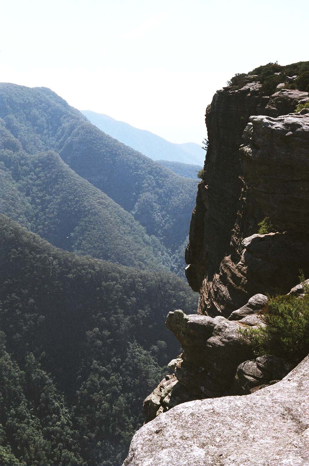
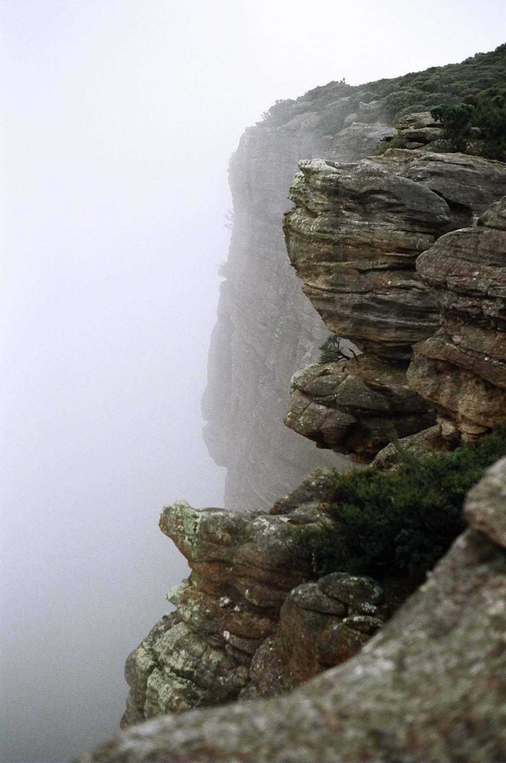
Looking into Kanangra Gorge, Saturday morning.
Kanangra Walls, Cloudmaker, Ti-Willa, Compagnoni pass, Kowmung River, Gingra Range, return to Kanangra Walls.
Descriptions refer to map 'Kanangra' 1:25000 topo.
Friday 20050401
The intention had been to pack up on Friday early, and leave in time to arrive at Kanangra in daylight. Ha ha ha. Kept working on fitting my study doors till around 6pm, so I could leave with them already hung, for less wife grumbling. Damm, solid core doors are heavy!
Finally got packed up (in the sense of having everything to take thrown in the car in a heap) around 8.30pm, with only the maps to dig out yet. More Murphy - turns out the maps are in a box deeply buried in the study mess. I get on the road around 10.30pm.
Uneventful drive up to mountains. Road down to Jenolan from the Sydney side is undergoing major works - looks like they are replacing whole sections of it with concrete structures, to combat slipage. Signs saying road is closed some evenings - but not tonight fortunately.
At Kanangra, around 1am, out of curiosity I drive into the Boyd River public (pay) campsite. Quite sad to see what its become, compared to how beautiful and natural it was in my childhood. I drive off, and go find a free and un-stuffed place to camp. No shortage of them. Tonight I stop at the junction of the 'Boyd Range track' (per my 1971 inch-to-mile map, turnoff to Sth about a mile past Boyd Crossing), and the Unirover trail (according to a signpost at the junction.) Lovely open, mossy forest, soft grassy ground. Even in the dark its tempting to just wander off into the forest. If I'd needed water, could have driven a little further on, to Dingo Creek crossing. Next time. Or another few Km, to the very nice campsites at Morong Ck crossing, where I last camped in July (?) 2003 with a friend.
Its late, I'm lazy and want an early start, so I sleep in the car. Discover that my airmat is now a non-air mat, so its not a comfortable night.
Saturday 20050402
Wake late, around 8am. Breakfast, then spread out everything on the ground to select and pack. Cull 'wanna-takes' until it all fits in the pack. I must get a smaller tent! In the process, it later turns out that I forget to pack: powdered milk (despite having some for breakfast), spare socks, rain overpants. And I choose an older oiled black japarra rain jacket, rather than a newer nylon camo one, for old time's sake. Which turns out to be major mistake number one. Not too happy about how little warm clothing I'm taking, but heck, looks like fine weather.
Get to the Walls carpark, and under way, around 10am. So much for the planned early start.
Its a very beautiful day - perfect for walking. Sunny, cloudless, calm, but relatively cool. The bush on Kanangra tops has had recent rain, so there will likely be water out at Ti-Willa plateau. In any case, I'm carrying about 3 liters.
Out on the walls, at the junction for Mt Maxwell vs Mount Brennan, I stop at the open rocks next to the cliff edge. So far, thoughts of why I'm here have been hovering in the background. Mostly, its those I'm missing, who would all have loved to be here, now, if they were still alive. My dad, and my grandfather, and David Hume (Mullet) and Michael Carlton (Predator.) My dad's middle name was Kanangra, and my grandfather and grandmother had first brought him here when he was a small child. They'd had a special 'ruggedised' baby pram made for the trip, which I remember seeing among the junk in storage when I was a child. Growing up, I'd been on several walks in this area with my dad and his mates - one walk out to Ti-Willa plateau, and onward in a different loop than the one I'm intending this weekend.
Sitting there, looking out over that huge chasm, it quite suddenly occurs to me that if dad and Mullet hadn't died when they did, it would have been possible, and even likely for us all to go on walks together. Dad got cancer, but was still an active bushwalker and would have been for many more years. Mullet died on what was to have been his last Himalayan climing expedition, before settling down to raise a family with his wife. She'd made him promise 'no more', and he'd agreed, since the statistics are that of people who go back over and over, about 50% end up dying in climbing accidents there. "One last attempt" he'd said. How ironic. Anyway, he'd have been doing more walking here, for sure. I must go back to Gerringong Falls and redo that walk he showed me, with the amazing descent down seemingly impassable cliffs, through a tiny squeeze hole and cave.
My father, and my two best friends, all dead far too soon. So much lost. For a while I sit there in tears, and feeling a very strong call from the edge. Plenty of other sorrows and loss and troubles that one little step would fix so easily too. Not surprising, how strong that pull is.
But no. There are still battles to be won, and intriguing mysteries to be revealed. The future still has some paths that could turn out well enough to justify keeping on despite all this pain. Besides, what the hell is going to happen in the world? I'm dying to find out. Or in this case, not dying - unlike most of my friends.
For the moment, I have a hopefully very good bushwalk to get on with. Perhaps events may even grant me a gift such as the time my father and I had visited Ti-Willa together, long ago.
That walk, there had been one of those transcendent moments one has now and then in life. We'd got to Ti-Willa late, in the dark. After camping, and a meal, I'd wandered (well, scrub-bashed really) alone up to the crest of the rise in the dark. Maybe about 9pm. It was cold, and the valley below had filled up with cloud, nearly to the lip of the plateau. At the top, the scrub is only waist high, so from here the views are clear - and _very_ distant, of ranges far away to the east. Which right then were entirely covered in low cloud. And a nearly full moon was just rising. So it looked like the darkly moonlit plateau top was floating on an endless white moonlit misty sea. In my teens then, it was perhaps the most beautiful, mystical, magical thing I'd ever seen.
Too bad its only half moon at the moment, and clouds seem unlikely. But you never know.
So I continue on, out to Mt Brennan, and the cliffs looking out over Kilpatrick Causeway. Here's another view that always reminds me of mystical fantasy artwork. The track below on the causeway is quite visible, and winds off into the distance, into the receeding line of peaks and ridges. It looks like a path into some other world. 'Follow this path faithfully, with a true heart, and come out somewhere else, where things are not so totally fucked up as they are in this world.' I wish.
In any case this is where the day picnic-ers give up, so from here on it feels more like being away from the crowd. Seems like moving this walk a week after a long weekend was a good idea too - so far I've seen only two people back at the carpark - and there were not many cars there anyway. Amusingly, one subaru identical to mine, but without the dings. So I parked right next to it. Out on the Walls - nobody.
Coming up the ridge to Crafts Wall, it's interesting to find how persistent memory is. I'm sure I've not been back here since the walk in my teens, over 30 years ago. Yet I am still remembering the layout of things here. There was a cave... and there is. Now it has a blue plastic icecream container on the floor, which turns out to contain a visitor's book. I read a few entries - the last people came through yesterday, and it seems there's quite a bit of traffic - several parties a day, sometimes. Most doing the Kanangra to Katoomba via Dex's creek 3-day walk. Ah! Good - I find a note by someone who's come round the trip I want to do now, but in the other direction. And they name the ridge they came up from the Kowmung. So now I know one that definitely works. Wasn't too sure about that bit, but was leaving it as a puzzle for Sunday. Later events make this information rather amusing in hindsight.
After that, it becomes something of a long slog along the ridge. With the usual constant descents and climbs, just to keep you tired and hot. The day has warmed up, and I'm very glad of having a lot of water, and the few times a rocky outcroping provides a cool place to rest. Time to change to shorts.
My grandfather, Myles Dunphy, played a large part in having all this country declared a national park. He and his mates had spent many years walking here, long before there were topographical maps available. Myles was an architect, a very good draftsman, and he'd drawn up the early maps of this area from the sketches he's made on his many walks here. His maps are still in use today, because unlike the topo maps they also show a lot of 'walker's' detail, such as campsites, passable routes, water sources, etc. I couldn't find my copy on Friday night, so I only have a topo map - sadly.
One of the perks of being the one to draw the first map, is that you get to name a lot of the landscape features. So although he kept names already in common use, a lot of things had no known names. Hence the name series along this ridge: Mt High and Mighty, Mt Stormbreaker, knolls Rip, Rack, Roar and Rumble, and Mt Cloudmaker. That was all grandad amusing himself. He was also on the Lands Department geographical naming board, so he mostly got his names to stick. Even if he may have overdone the joke a bit in the Wild Dog Mountains nearby, to the north of Cox's River. Spotted dog ridge, howling dog ridge, brown dog ridge, spotted dog point, yellow pup ridge, etc... Sigh. I never did hear a good explanation.
Another thing I'd like to know, is WTF is up with my knee joints? By about 2pm, these are doing the same thing they've done before, and starting to get really painful. Something with the cartilage in the joint outside bearing surfaces. Enough to make walking both unpleasant, and a lot slower than it should be. I'd hoped to make Cloudmaker by lunchtime, but I only make the saddle between Stormbreaker and Rip by about 3pm. So I stop and have lunch there. It's a very pleasant spot.
Sitting there, cutting into the food for the first time (eat more, it makes your pack lighter!) I'm enjoying watching all the tiny wildlife (ants, skinks, spiders, etc) that are scurrying around in the leaves, leading their busy lives, when another bit of the wildlife introduces itself to me. You know that feeling - something touches you unexpectedly, and you go "Gagh!" and take a swipe at it? In this case, I'm wearing a loose t-shirt, and something goes *bite* on my exposed collar bone. I go *swat* back, but it doesn't come off. Oh, OK, a leech. Fine. Getting a good grip on it, off it comes, hopefully before it got well started on me. Yep, no blood.
Anyway, no one harmed, including Mr Leech. Who is a remarkably fine looking specimen of his type. Really quite pretty, big, and very active. Fully extended, he (it?) is about 3" long, and has some quite cute looking yellow and red markings near the thick (sucker) end. I get him on a leaf, and enjoy playing tricks with his heat-sensing thin end, as he waves it around trying to figure out what is going on, and where did his lunch go. He can definately 'see' me, but is easily fooled by a warm hand waved around rapidly. Very little brain, leeches. Quick though, its hard to keep him on the leaf, and not sinking his sucker onto my fingers. Eventually, I suggest he 'go fetch', by tossing the leaf with him attached several meters away. I figure it will take him quite a while to re-lock on target and loop-hop his way back to me.
After lunch, the knees have mostly settled down again, and I start the climb up to Cloudmaker as fast as I can. I do *not* want to be coming down the other side, trying to find a campsite in the dark. Not to mention that I'll need to be finding water. Getting up takes about an hour, so there's no time to muck about at the top. There's a real visitor's book this time - a lot of effort has gone into making a nice stainless steel weatherproof box, and setting it into a stone at the base of the cairn. A quick snack as I read some of the entries, then sign it, and get going again. Quickly looking at the entries, it seems most people were passing through on the Kanangra to Katoomba walk. Hence the obvious track in both those directions. But the third possibility - down to Ti-Willa, is much less travelled. So this is where the easy following of clear tracks stops for me.
Mountains are like drain systems, only in reverse. Drains are dead easy to follow going downstream, because usually all branches converge. On mountains, it's very easy to get to a peak by simply going up - all the ridges converge. But going down can be another matter entirely. And of course, you typically can't see shit, because of all the trees blocking the view. Its awfully easy to go down a wrong ridge, and then have a whole lot of work to get back where you want to be. And now, I'm pushing the end of daylight. So it's compass time.
It turns out there is a faint track down the SE side of Cloudmaker - for about 100 meters or so. Then it's dead reckonning. Easy enough here. I make it to the saddle at the NW edge of Ti-Willa by dusk. Its fairly open stunted forest, merging into very dense scrub and heath out on the plateau. Could camp here, but there is no view at all. Thinking of that moonlit night long ago, I'd been hoping to find a campsite somewhere out on the top, with a view over the valleys to the east. So with the light fading, I head out into the heath. Hmmm... This stuff has grown up a lot since I was here last. In fact... battle.. its... push... grunt... very, very thick and taller than me in places. Even after a quick change to long pants, it still wasn't working fast enough. I get close to the top of the rise, then hit a really dense bit, that's just impassable. Besides, even if I do find a good camp spot there (and there is not much firewood on heaths), I still have to go back to find water.
By now, there is just enough light left to go hunt for water. So a change in plans. I reverse tracks to the saddle, and follow the depression down to the west. The soil is damp, and there are small soaks, but I'd like to find running water. Dripping even, will do. It's clear there is plenty of water here, but it's flowing in the ground. In which case, we go downstream, looking for a rocky seam to bring the water up to the surface. Dense scrub here in the gully, it's not possible to stay right on the water path. Eventually, with the light really failing now, I find a small rock pool with water trickling into it. Fill up one bottle using a cup to scoop up water. Looks good, it's filtering in through moss, there are tadpoles, I'm happy to drink this without boiling. One bottle is enough, it's now a tradeoff between cooking needs, and light needs. I start back up the 'creek', and of course within 50 meters find a much better, bigger, deeper pool, with a greater flow. So fill the other bottle and canvas water bag. Then head away, for final attempt to locate a camp spot on the plateau. I have a faint memory of a particular rock outcrop, that should be possible to find.
More bashing around in heath, this time not so bad since I'm trying more to the western end of the plateau, where the scrub is stunted by gales and so lower. But now I'm carrying a full canvas water bag in one hand - which makes for two problems. One is trying not to puncture it on pointy sticks, and the other is that the canvas weeps, and drips, so you get wet.
There comes a time, when bashing around in the dark, looking for someplace that may not even exist, that a known good camp spot (back in the open forest of the saddle) overcomes the appeal of trying for a spot with a view. There's no point using a torch to find your way around unfamiliar landscape in the dark - it just doesn't work. But with just the faintest of light left, to see the clump of trees I knew marked where I'd originally come onto the plateau, I gave up, got out the torch, and headed for 'home'.
What a relief to get back into open ground! A quick hunt around for a nice flat spot to sleep, with a good site for a campfire adjacent (that means, a bit of a clearing with a big log to sit on), and at last! The defining moment of a day's hard walking - when you put the pack down for the last time. Ahhhh.... Apart from the lack of mystical moonlit landscape views, this spot couldn't have been better. I love it when one has to clear aside the firewood, in order to make a fireplace. This area doesn't seem to have been burnt for many decades. Some would call it 'litter'; I call it not having to hunt for firewood. And the ground is soft dirt, with leaf cover - makes for easily preparing a comfortable sleeping spot before putting the tent up. Flat, head end slightly up, small hollow for the hips, no stones or twigs. Put the tent base sheet down, have a quick comfort test lie down - too late to fix problems later. Add the rest of the tent. Another great invention - tents that can be put up anywhere, having a system of foldup, springy ridge poles. So much more convenient than the old cloth 'A' with a rope along the ridge. Even if my grandad did invent that system - finding a very light- weight japara cloth, oiling it for waterproofing, sewing in the ridge rope, flaps, flystrings, etc. When various friends of his wanted him to make them copies, he was too busy so his mate Paddy Pallin started producing them. That was the start of the well known Paddy Pallin outdoors equipment company. Trust a Dunphy to miss a lucrative business opportunity.
Those old cloth tents had their good points - mainly extreme simplicity, very low weight, and folding pretty small. All you needed was two trees to string the rope between, some tent pegs to tie the side stings to, and a few rocks to hold down the side flaps. But they had no floor, and although a mosquitto net could be added they didn't keep out ground bugs. But then if they did, I wouldn't have had the interesting childhood memories of a scorpion sting on a finger, or waking up in the middle of the night to discover a migrating yabbie sitting on my chest. The yabbie was taking a short cut across a bend in the creek, and my tent was in the way. I've no idea what the scorpion thought it was doing. The yabbie survived, unlike the quickly squished scorpion.
Anyway, it sure is a lot easier to find an inviting looking flat spot, if it doesn't have to be directly between two trees.
A lot of things really are better these days. Torches for instance. Used to be, torches were really crap. They were either big bulky D cell things (with weak bulbs), or 'penlights' (two AA cells) also with weak bulbs. Those were nothing like a solid maglite today. The body was thin-walled, so they easily got bent in packs. They had patheticly failure prone twist switches at the back, and used bulbs with an inbuilt (poor) lense. Maybe one reason the switches always failed, was that people would resort to holding the torch in their mouth, so saliva would get into the switch. Also battery technology was miserable - carbon-zinc or nothing. So torches on bushwalks were very problematical. The common way to illuminate the inside of a tent, was with candles - you'd melt some hot wax onto the middle of your aluminium plate, then set the candle into that. And then be very careful not to knock it over and set your tent on fire. As for torches - if it didn't fail, it was too dim. And you would be always juggling, trying to do everything with one hand while the other held the torch. At one time, I got so fed up with it all (penlight flakyness) that I made one myself out of brass, with clips so it could be pinned to a beanie for hands-free use. That one still works nicely, but uses a screw-base incandessant bulb, with its own lense. Compared to LEDs, it's archaic.
This night, as I cooked dinner (a slothful dried packet meal, plus bread, salami, cheese, etc) with my LED headlight making things so bright and easy, I thought of what astonishment such a thing would have caused 30 years ago.
It was an absolutely still night, not a cloud in the sky. But, no views, little moon, and me feeling fairly stuffed. So an early night - around 9pm. Still unsure what I was going to do tomorrow. The known way down off the plateau, 'Compagnoni Pass', is right up the other end of the plateau - two miles away. Given my lack of progress today with the scrub, I didn't like the sound of that. And yet, according to the logbook back at Crafts Wall, someone had done it just two days ago. Wish I had the Gangerang sketch map, since it shows routes and features. I thought that perhaps I could push over to the far side, and walk along the cliff tops?
Sunday 20050403
Woke around 7am. Another perfect, still, clear day. There was some wind during the night, but it doesn't seem to have brought any change in the weather. At breakfast, I discover that I've forgotten to pack powdered milk, so the muesli (homemade- rolled oats, allbran, sultanas, almonds) is rather plain with just water. Last night I'd left out the remains of a cheese sandwich, to see what happens. Its been moved slightly, and there are odd bite marks in the cheese. No idea what it was, but seems it didn't like cheese much, and bread didn't interest it at all.
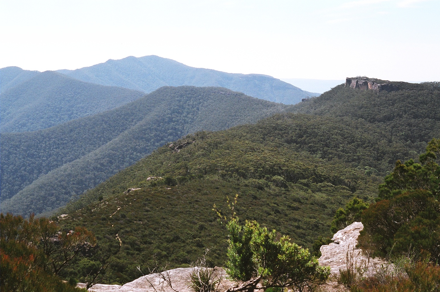
Packed up, I head due East, for the other side of the plateau. Oh boy, this stuff is dense. In daylight its easy to get past the point I got to yesterday evening, but it just keeps getting worse. Not too bad near the top, and at last I can see the view to the East. Its actually the first time I've ever seen it, since the other long ago trip I recall we never went to this side of the plateau. And at night, I only saw the clouds. This day I took a panorama shot, hope it comes out.
After much, much bashing through dense interwoven wiry scrub, and at times crawling along pulling my pack through after me, I sort of reach my goal. It turns out, that there isn't a 'cliff edge' as such - only a series of irregular drop-offs and inlets, in a varying but always high cliff line. The concept of trying to negotiate 'along the cliff tops' to the NE simply isn't feasible.
So I'm now considering alternatives. They are:
1. Go back to Kanangra Walls today, via Cloudmaker. But thats boring.
2. Stay here today, enjoy the views, camp in same spot again tonight, go back via Cloudmaker tomorrow. Better, but still a repeat walk.
3. Looking at the map, there is a long ridge going due South off the very Southern tip of Ti-Willa. it goes down to Gingra creek, and another ridge rises up from there to Gingra range, along which I was planning to walk out on Monday. If i could get down here, I'd still have a three day walk, but much shorter. Cons: a) Missing out on the Kowmung River, and b) its risky, rough, steep country, and no one would have a clue where I was. Hmmm... very tempting.
4. Try negotiating along the back edge of the plateau - I seem to recall thats how we did it years ago.
Anyway, here I am on the SE edge, close to the tip I'm looking at on the map. Might as well go see if there's a way down. Looking at the treeline, looks like there might be. About an hour of thrashing around in the dense scrub later, I've made it through a few hundred meters, to the southern point of the cliffs. Absolutely fantastic views! I set down the pack, and wander around a bit, exploring. It turns out that there is an 'almost' way down. Actually quite do-able, if I wasn't alone, and carrying a pack. The overall cliffline is maybe 50 meters average, but at one point the top steps down, and the bottom has a boulder pile, and there's only about a 2.5 meter drop, that looks climbable. But.... it's one of those 'no way back' traps. I'm not going down it, unless I'm sure I can get back up. Dammit. So frustrating! Wish I had a climbing rope. This spot begs to have a few steel spikes put in.
Of course, the other big problem to this whole idea, is that the map shows a second line of cliffs further down the slope. I can't see them from here, and although the map shows them 'ending' a bit to the right of where I am, it's obvious from both the map and looking at the slope, that the difference between 'cliff' and 'slope' can get a bit ambiguous. Some 'slopes' might as well be cliffs. I don't much like the idea of scrambling around down there, looking for a route on my own.
So, reluctantly, I give up on idea number 3. Which leaves only number 4. Back we go to the campsite. This time I skirt around to the west of the denser heath, and getting back is relatively painless. By the time I regain the campsite, its 10.30am. I dump the pack there, thinking by now that I'll probably have to camp here tonight and go back via Cloudmaker tomorrow. Head off to scout around.
No point staying in the open woodland, since going N to NE in that just gets me down into a valley behind the plateau. So, I work along the upper margin of the plateau, sticking to the edge of the dense scrub.
Bingo! Very quickly, I find a track heading in the right direction. It just forms up, apparently as all the other people who've been in exactly the same situation converged on it in the past. I follow it for a way, and it gets stronger, but oddly slips off down the NW edge of the plateau as the cliffline elevates out of the valley on that side. I figure it must pop back up further on somewhere. Don't want to go too far, since I have to go get my pack, and time is getting short if I want to make it down to the Kowmung river today. Race back to campsite, grab pack, head off.
The track keeps on going, now along the base of increasingly tall cliffs. It comes to a really big cave, not marked on the topo map. Dammit! I wish I had the Gangerang map. Later I find out its called "Hundred man cave" for obvious reasons.
The bad news is, that the track goes no further. This really pisses me off. The good news, and an amazing coincidence, is that I explore a little bit further along the cliff base, and come to a narrow canyon cutting in. It's less than shoulder wide, so dumping pack, I explore it, and discover that it appears to be safely climbable. I get about half way up to cliff top level inside it, when I hear voices above. Calling out, they answer. I ask if they know the way to Compagnoni Pass, and it turns out they have just come from there. I get out and talk to them briefly - everyone is in a rush, them and me. They tell me the scrub mostly cuts out to the Nth of here, with the rest of the plateau being open forest again. Yay! They are intending to make Kanangra Walls today - wow! So off they go, and down I go to get my pack. Didn't even have time to find out who they were. Party of about six.
They are right. One of those cases of 'oh if only I'd known'. Sigh. Its pretty easy walking, with not much up and down from there on. A few thickets in the gulleys, but mostly open. By about 1.30pm I make Ti-Willa mountain - the last in the line, from which it's a ridgeline East down to the Pass I'm looking for - but which I don't know what it looks like. The map has 'Compagnoni Pass' written right on the point of the cliffline. Oh well, can only go see. I still have time to go back to my original campsite if I can't find it. I set myself a deadline - if I'm not at the bottom of the Pass by 2.30, I'll head back. If I am, I'll have lunch there, then go on. I definitely, most definitely, don't want to be still thrashing around on ridges when it gets dark. It's quite hot by now too.
Finding the point is easy - its very definately a point! And it has a nice acacia grove on the edge too, so the ground is deeply covered with acacia needles. And there is a cairn near the cliff lip too. So far, so good - it must be here somewhere! But where!? Slippery acacia needles on slopey ground, next to huge cliff edge, with tenously rooted thin trees that don't feel solid at all... Sigh, this is so much fun. After some hunting, it turns out you go down here, along there, down, along, and ah ah! Some steel spikes set in a rock. Then a chain. So thats it. Back we go for the pack. Down at the bottom, lunch at last! And its just on 2.30pm. Pushing for time, but should be OK, looks like its a very easy ridge to find and follow, and the 'turn right' to 'Stockyard Spur' should be easy to pick, since it's off the major knoll.
And here, I've made a very big mistake. Being in a rush, and fixated on getting down the Pass, and having lunch by a certain time, that I didn't think to have a good look at the landscape from high up, where it was possible to actually see it clearly.
So after lunch, I pack up, get out the map, and look around. I had my compass in my pocket, but on first look through the trees, thought 'oh, that ridge over there, with the knoll, that looks exactly like this one on the map- the one I want.' Idiot. Didn't even check compass bearing. And gee, it was only a few degrees off anyway. Like maybe, 30 degrees. Worse, as I went down to it, the land shape did more or less all the right things. So, reconstructing events after the disaster, it seems I went down the ridge to the Sth of Willa Creek, not the correct one, to the Nth. Both go in about the same direction, both have a knoll, both have a ridge (of sorts) heading South-ish from the knoll. But oh boy, do things go wrong right after that!
Stockyard Spur, which I should have been on, gets narrow and mild-grade. What I was on, turned into a plain slope, and just kept getting steeper. By now I knew I'd fucked up, but couldn't figure out how. Maybe I was coming down the slope to the NE of Stockyard Spur? Surrounding hill shapes didn't seem to make any sense for any of the possible places I could be. Ha ha ha! Oh, and its like 3.30pm now, and dusk is at 6.30, and there's nothing but 45 degree slopes as far as I can see. Terrific! Going back up not an option either - too far by now. Can't even see whats at the bottom here - whether it's the Kowmung, or some minor creek. So don't know which way to sidle around if I don't go straight down to the bottom.
At least that problem could be solved - keep going straight down, and find out what's at the bottom. It turned out to be a minor creek, and attempting to follow it down (it must go to the Kowmung) proved to be exactly as impossible as I knew it would be. Impassable tangle of vines and prickly thickets, alternating with slippery wet waterfalls and cliffs. Trying to push through is either a battle with vines and branches that seem to latch onto your pack in out of reach places, or a risky dice game where the booby prize is slipping on wet rock and breaking bones. The only possible thing to do, was follow contour lines around the hillside, more or less, on 45 to 70 degree slopes covered in cutty-grass, while attempting to not fall down any of the numerous small cliffs.
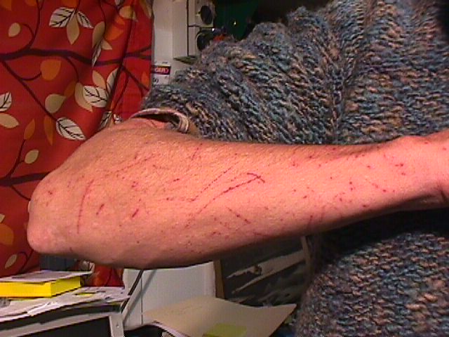
Normally, I recognise various harmfull vegetation, and take care with it. Nettles, cut-grass, thistles, blackberries, etc - everyone recognises them. I've just learnt a new one. A fairly ordinary tree I was swinging around (steep slope, remember) caught a small branch on my pack. When it whipped free, one of the broad leaves slapped its underside along my bare forearm. OWWW! F*** that hurt! Immediate huge stinging welt. Oh good, this is really making my day. Kept going, making sure to stay clear of those trees in future.
Avoid this plant.
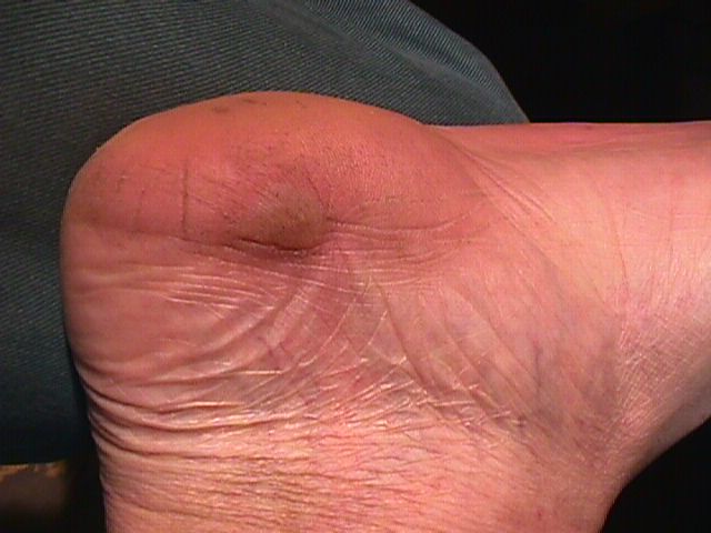
Eventually, I figured out what had gone wrong, and that the only thing to do was keep pushing on around the hillsides, ridges, and gullies, till on the side of Stockyard Spur. Which I did. Fingers crossed. If you've ever tried walking a long way, on ground always sloping off to one side, you'll know it really stuffs your feet. Nice blisters on the left side of the foot, in this case. At least today the knees seemed to be holding up.
By the time I was sure I was on Stockyard Spur, it was definitely going on dusk. Which made me think it would be really nice to find a track I could simply follow down to the river. So, while still traversing around to the South on the spur, I was looking for the end of the ridge, and expecting to find a track along its spine. Since, it seems many people come this way.
Out of luck again. It was Stockyard Spur all right, but not enough people travel it to have worn an actual track. So I'd gone right around the end, before admitting there was no track, and I might as well just go down. Getting dark anyway, and only a few hundred meters more to river level. Came out on a nice grassy river flat, with a well worn human/horse trail, and maybe a few minutes of usable light left! At last, this is the Kowmung, horray! Nice to be back after several years.
It's obvious that I must be a little to the north of the Gingra Creek junction, where the campsite is. So head off south along the riverbank, and come to the junction in a few minutes. Yep, there is a perfect campsite up on the higher flat, and there, leading off up the hill, is the Gingra Range track, that I go back on tomorrow. A great feeling to become 'un-lost'. Find a flat spot to pitch tent, dump pack there, and charge around in the very, very last light finding some firewood. Put up tent, toss in most of the gear.
Ahh.... essential chores all done. And oh man am I knackered. Its also too dark to see anymore, so out with the headlight. That was definitely cutting it fine.
Much earlier in the day, when I'd been thinking I'd get to the river with plenty of light left due to making an early start and the relatively short distance to travel, I'd imagined how nice it would be to relax here, and have a swim in the river. It's deep enough, and the day was warm. Now it's nearly 7pm, I'm exhausted and t-shirt soaked in sweat. And I still have to fetch water, which is best done from a deeper part of the river, not the shallow edges. A quick wash now will make for a much more pleasant evening. And, since tomorrow will likely be warm, maybe I should rinse my t-shirt, which is fairly rank by now. It won't matter if I don't get it completely dry by the fire tonight.
Gathering up what I need in a cape, I head back down to the river. It's always amazing how different things look by torchlight, even though you were just there moments ago in daylight. Lay out my clothes on a sheet, and wade in with just the headlight and water bottles. Rediscover the blisters - walking on smallish slippery pebbles in bare, sore feet doesn't work well. Must have looked pretty ridiculous, but fortunately no audience. For miles and miles around, I expect. I wouldn't be surprised if tomorrow, Monday, I'm the only person in the entire Gangerang Wilderness.
Apparently, the Kowmung's entire population of sand midges is well aware of that fact, and is trying to make up for expected downtime. Either that, or they really like the light from LED headtorches. Quite amazing - if I stand still, they form up into a dense column in the torch beam. Turn the light off, then on, and they are all gone, only to return in moments. The light seems to make them forget they are supposed to be biting, which is lucky for me since I offer a lot of exposed skin area.
Filling water bottles from a stream has a few tricks that not everyone knows. When you will not be boiling the water, these are quite important. The first thing, is to be very careful to not get any bottom sediment in your drinking water. That greatly reduces chances of picking up some parasites. The less obvious one, is that you also don't want any of the floating particles or insects from the surface. There is only one way to achieve both these aims - Find a spot (with flowing water) deep enough to completely immerse the bottle without touching bottom, and hold the bottle tilted, opening upwards, but still a few cm below the surface. Bubbles come up, but the water going in is from the level of the bottle opening - not the water surface.
Filling a water bag also takes care. If you have enough depth, with a clean rock bottom, you can just swoop the bag under the water to fill it. Otherwise, use a cup to fill it, again without stiring the bottom. Normally, the waterbag is used for campfire cooking, washing, etc water only, so its cleanliness is not so critical.
Back at the camp, feeling much warmer and cleaner (and aeroguarded) it's time for dinner. Soup, then half a dried rice meal, with tuna mixed in. Plain, but filling and warm. My freshly rinsed t-shirt is steaming on a log by the fire. That certainly was a busy day.
Having had my navigational self-confidence horse-whipped by the Stockyard Spur Fiasco, I am extremely glad that tomorrow will be a kindergarden exercise, involving following a very clear track, up along a simple, almost entirely straight ridge, till it reaches the area of Kanangra Walls (which I know very well.) Hopefully, if I pay attention, nothing can go wrong tomorrow. However I check that yes, I do have plenty of food for another day. Or two. Interesting high clouds, blowing in rapidly from the west. Around 9.30pm, absolutely tired out, I gladly go to bed.
Monday 20050404
Sometime in the early morning, it starts raining lightly. Oh well. I wonder how waterproof the tent is these days? Its not looking so good, I bet the outer fly sheet is pretty leaky by now. Still, drips tend to just run off the inner nylon cloth. Ho hum, back to sleep. I love the sound of rain on a tent. As long as it's dry inside...
Around first light, I wake up again. The rain is much heavier now, and I realise the top of my head, against the tent surface is wet. Eh? Get up, check with torch. Oh rats. This is not a functional tent anymore. The outer sheet has become completely porous, and the inner one is _mostly_ still shedding water. But not entirely. Plus... oh, why list the leaks. In any case, there was no point lying there, with all the gear getting wetter. Looks like it's going to be a wet, wet day, so I'm glad I've got the rainjacket _and_ cape. Hmmm.... and its been a while since the jacket was re-oiled too, I wonder...
I dig out the plastic garbage bags from their pocket in the pack, and sort stuff into them, for packing later. After taking the tent down in the rain. Something that's so much fun, plus several kilos heavier to carry.
With all the essential things (sleeping bag and mat, warm clothes) secure in garbage bags, I have a quick breakfast in the ever-wetter tent. Then jacket on to face the rain. Put the garbage bags of stuff outside in a heap, other things like the pack underneath them to reduce sodden-factor.
Within moments, it dawns on me that what I am wearing is a rain jacket no more. It might be, with a bit more oil soaked in. But now, it could as well be an old dish towel. I've put the still-damp t-shit back on, and its becoming the very damp and a bit cold t-shirt, with the even more wet shorts to match. Oh well. I guess I'll warm up when I start climbing that long, long hill. Overall, I'll be climbing around a thousand meters today - but with all the ups and downs, probably several times that. The distance will be about equal to the sum of the last two day's walks. Definitely something to get an early start on.
Another factor is that the very last part of the walk, a couple of hours worth, will be late in the day, when I'm exhausted, and across the very highest part of the local topography - the Kanangra Tops. Well known for being freezing cold in poor weather. So although I may be cold now, I think considering I won't be able to keep what I'm wearing dry, that its best to keep most of my warm clothing put away in garbage bags, to use for the last part of the walk.
In rain, its best to dismantle the tent from the inside out - leaving the frame and outer sheet for very last. That way the inner parts and floor can be folded up with a minimum of extra rain absorbed (and every extra drop of water is more to carry all the way back to the car.)
By 7.30am, I'm ready to go. It's still raining a little, but looking like it will quit soon. I don't know if it will fine up and get hot, or stay cloudy and cool all day. So I have to carry water for the worst case - it gets hot. It's a long, long walk, along a waterless ridgetop. Three litres of water, plus a lot of the gear wet and heavy. Sigh. Off we go. It would have been nice to have enjoyed a little relaxation time in warm daylight on the banks of the Kowmung, with old memories. Oh well. See you later, old friend. Next time, if there is one.
I hope it wasn't my grandad who named the peaks along Gingra Range. Not very imaginative - Third Top, Fourth Top, Fifth Top, Sixth Top. But what really sucks is that they are named counting up, by someone coming down the range. So if you are climbing up, which is much harder, it's much less satisfying. You don't even get to count down to one, since the first few have names not numbers. But I'm getting ahead of the story.
It stopped raining quite soon after I started up. Which makes no difference at all to how much wetter you get with a spongelike jacket, since there are a lot of bushes to be brushed past, against and under. All still laden with water in the misty air. Lots of effort climbing, but it wasn't getting me warm. Worse, the cold set my right knee off into its 'I don't want to do this' snit again.
After Sixth Top (the first), it gets fairly flat for a while, which was good for the knee, but very quickly bad for the body chill factor. Obviously, the idea of drying out the t-shirt by wearing it, and saving warm clothes till later wasn't going to work. A quick, shivering stop, to swap the t-shirt for the woollen jumper, and stuff in some sugar and protein (mars bar, nuts, salami) plus take an asprin for the knee, and off I go again.
A bit warmer... for a while, till the foliage water once more started to penetrate the so-called rain jacket. But it was better than before.
For the range section from Fifth Top to Fourth Top there were some fine views back up towards the clifflines of Ti-Willa Plateau. From here, the lower line of cliffs was perfectly clear, and I was very glad I hadn't attempted to find a way down or around them. Might be possible, but definitely a task for a larger group. With helicopter rescue on call.
After that, it was all cold, hard slog. The asprin worked to obscure the knee pain, mostly. Mist worked to obscure most of the view. I have to say that for excitement and interest, don't bother with the Gingra Range. The best part of it, was getting to the end, with a final steep staggering grind up to the coal-seam cave at the base of the Mt Maxwell cliffline, below Kanangra Tops. By then it was about 4pm. Apart from a few brief pack-downs, I'd not actually stopped the whole day. Too cold to sit and rest - every time I even stood still for long I'd be shivering and the knee would be agony to get bending again. By now I'd given much thought to my careless decision to not bring the waterproof overpants - without which putting on my cotton pants would be worse than pointless.
The goal was the cave, with preferably a couple of hours light left for the Tops. But I could do that in the dark if I had to. Mostly I was looking forward to having lunch, and putting on all my warm clothes. They'd stay warm for a while, till they got wet too - but it would do to get back to the car. Where I had a nice dry, really warm set waiting.
It's a wonderful sight when you are cold and wet, a big expanse of dry space. I'd hoped there might be some dry firewood stashed, but no such luck. A heap of wood, yes. But outside the cave, in the rain. Never mind, no time anyway. Spreading the wet clothes, cape, jacket, jumper, etc around on the dry rocks, I stuffed down as big a lunch as would fit. And tipped out two litres of water - *not* going to be needing that! Could have ditched it sooner, if not for the nuisance of unpacking to get to it.
Despite all this, I was quite looking forward to getting up onto the Tops. One thing I really like to see, is cloudy mist drifting low across a landscape. Something to do with early childhood car-camping holidays with my parents, to Kosciousco, and this area. Or maybe it's just intrinsically majestic and beautiful.
In any case, the clouds were low above, and probably would be lying across the Tops. Cold or not, I wanted to get up there, and into the white. Fuelled up, wearing a flannel shirt under the damp jumper, and all packed again, set off around 4.30. By now I'd found that wearing the leaky cape over the leaky jacket, and keeping my arms mostly crossed in front of me, I could cut down the seepage rate quite a bit. Keeping an airgap between the two non-waterproof layers seemed to work, apart from my arms getting cold. So, it wasn't too bad.
Warm enough that the experience of walking across the cloud-draped moors and forests of the Tops was as wonderful as I'd hoped. Very, very beautiful, in the way forms fade off into vagueness, and drifting veils of mist hide and reveal changing parts of the view. Standing in one spot, the entire landscape will completely change, over and over. It's like watching nature's set designer playing with ideas for some great production. An impossible thing to capture in still photographs, since it's the movement that is most significant.
Arrived back at my car at 6pm. Changed to dry clothes in the picnic shed at the carpark - yay! Warm! Finally!
Called home to let Ra know I was OK. Indifference from her, apart from asking if I'd like dinner when I get home. I say no thanks, I'm looking forward to having a meal at one of the traditional post-bushwalk spots. She acts like 'well you *would*' and says goodbye. Huh?
Headed off, car heater blasting, and immediately ran into heavy fog. Oh well, I'm in no hurry. Just as well too, because the fog persists most of the way to the top of the hill down to Jenolan. There, the sign about road closure going up out of Jenolan indicates that the road will be closed now - arrrgh! And the only alternative is via Oberon. But some of the associated signs have drapes over them. Perhaps...? I decide its only about 5 Km down to Jenolan, even if a steep grade. So on the chance that the road _isn't_ closed, I head down.
Of course it is closed. So back up, and off to Oberon. Lots more driving than I'd expected, and the fog is everywhere on the highlands. So it's a long time till I make it to Katoomba - around 9pm I think. Tiredness beginning to cut in. Can't find the fish and chip shop I liked, and the Paragon is closed. So will be the diner at the Bell turnoff. So I end up having a pizza in Katoomba, sitting in my car to eat it. Hopefully counteracted sleep-wise by a can of V. Don't feel like phoning Ra again to inform I'm going to be later home than expected, since she obviously doesn't give a stuff.
Get home at 11pm, everyone already asleep. I make the mistake of turning on my PC, and get caught up reading till 2am, when I quit, have shower, and go to bed. In the morning (Tuesday), Ra is distant and unusually incommunicative. She leaves before Ella is ready for school, and I drive Ella. After I return, Ra turns up (walking), gets in car and drives away. Mysterious!
In the evening she's still incommunicative. I buttonhole her after dinner, just as she's about to go out for a walk, and ask her what's the matter. Ra now tells me that over the weekend, with me away, she's had a much easier time dealing with Ella. Implying as she often does that its my fault she usually can't control Ella. Hmmm. This is the woman who only last week called the police to our place after she'd had a physical fight with Ella, and wanted the police to take Ella away. And if she's having such a great time with Ella, how come she just moments ago organised Myles to help her remove Ella's TV from Ella's room? During which she pointedly ignored me as I sat there at the same table as Myles.
Ah, its nice to be back to civilisation. Or it would be, if I could find it.
Looking into Kanangra Gorge, Saturday morning.
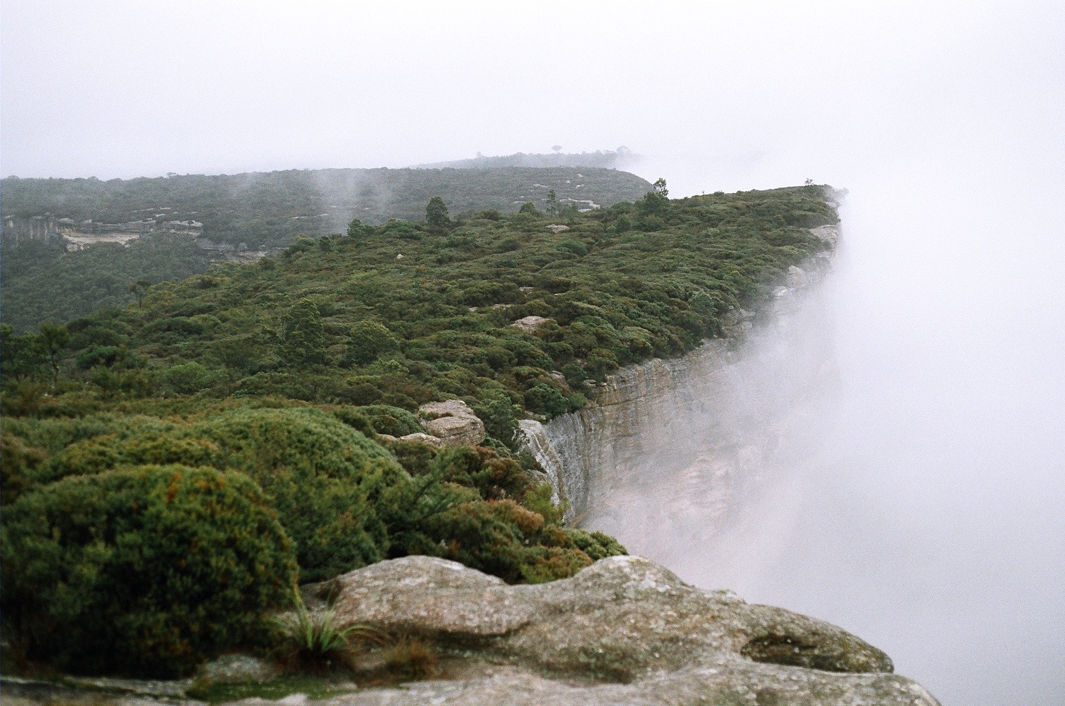
Same view again, Monday afternoon.
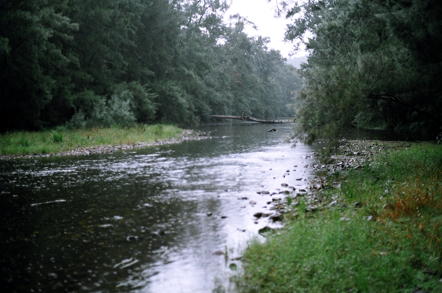
Kowmung River, at junction with Gingra Creek, early Monday.
Monday, coming back over Kanangra Tops.
Panorama view looking SE from near Sth tip of Ti-Willa plateau.
Minor damage